6 min read

3D Topographical Mapping for Earthworks Planning: What to Evaluate

3D Topographical Mapping for Earthworks Planning: What to Evaluate
13:58

Earthworks planning depends on an accurate representation of the existing ground surface. When the documented surface is outdated, incomplete, or unable to account for vegetation and recent site changes, the resulting cut/fill quantities can affect import and export assumptions, grading budgets, phase sequencing, and project schedules.

3D topographical mapping helps address this problem by creating a georeferenced model of the site’s elevations, slopes, drainage patterns, and terrain features. Teams can compare that existing-ground model with the proposed design to calculate material movement, evaluate site balance, and update quantities as grading progresses.

This article explains how 3D topographical mapping supports earthworks planning, how CAD topography, photogrammetry, and LiDAR differ, and the six criteria teams should evaluate when comparing terrain mapping and land development technology.

What Is 3D Topographical Mapping for Earthworks Planning?

3D topographical mapping creates a digital model of a site’s existing surface in real-world coordinates. Earthworks teams compare this model with grading designs and updated scans to support several core workflows:

  • Cut/fill analysis: Calculate material to excavate, place, import, or export.
  • Site balancing: Determine whether onsite cut can meet fill requirements.
  • Progress tracking: Measure grading progress against plans and earlier scans.
  • Elevation checks: Review lots, pads, streets, slopes, and other work areas.
  • Quantity verification: Compare measured work with contractor reports, invoices, or pay applications.

Outputs may include point clouds, terrain models, contours, and orthomosaics. Their value depends on accurate capture, processing, ground control, validation, and clearly defined accuracy requirements rather than visual detail alone.

What Is the Difference Between CAD Topography, Photogrammetry, and LiDAR?

The three common surface sources can all support earthworks planning, but they are not interchangeable.

Surface source Best suited for Main risk
Existing CAD topography Projects with current, reliable engineering or survey data. The surface may not reflect recent site changes.
Photogrammetry Cleared or exposed terrain where the ground is visible. Vegetation can obscure the actual ground surface.
Aerial LiDAR Vegetated or complex terrain. Results still depend on classification, control, and validation


Existing CAD Topography

Existing CAD topography may be a suitable baseline when it is current, complete, and based on appropriate survey or engineering control.

The risk arises when the surface no longer reflects current conditions. Clearing, previous grading, stockpiling, erosion, imported material, or undocumented site activity can change the terrain after the original data was collected.

Before relying on an existing surface, teams should confirm:

  • When was the data collected?
  • What site conditions existed at the time?
  • What control or survey methodology was used?
  • Have material or terrain conditions changed?
  • Is the surface suitable for the current decision?

Photogrammetry

Photogrammetry uses overlapping aerial images to generate a point cloud, surface model, and orthomosaic. It is generally effective on cleared or exposed terrain where the camera has a clear view of the ground.

When vegetation obscures the terrain, the reconstructed surface may include the tops of brush, grass, or tree cover rather than the ground underneath. The severity of this limitation depends on vegetation density, image quality, ground visibility, flight planning, control, and processing.

Photogrammetry may be appropriate when:

  • The site has already been cleared
  • Ground visibility is high
  • Frequent progress mapping is required
  • Visual documentation and surface measurement are both priorities
  • The expected accuracy has been validated for the intended use

Aerial LiDAR

LiDAR, or Light Detection and Ranging, measures distance using laser pulses. Some pulses can reach the ground through gaps in vegetation, allowing processors to separate ground and non-ground points and create a bare-earth terrain model.

That makes LiDAR mapping for land development particularly useful when tree cover, brush, or uneven terrain prevents image-based mapping from representing existing ground reliably.

Even with LiDAR enabled drones, teams still need to evaluate:

  • Flight and sensor configuration
  • Point density and distribution
  • Ground-point classification
  • Survey control and checkpoints
  • Vertical and horizontal accuracy
  • Processing and quality-control methods
  • Surface and file deliverables

When Should Land Teams Use LiDAR Instead of Photogrammetry?

Land teams should consider LiDAR when vegetation materially obstructs the ground or when the project requires a defensible bare-earth model before clearing.

Photogrammetry may be sufficient when the site is open and the ground is visible. LiDAR becomes more relevant when the surface must be measured beneath brush, grass, or tree canopy.

The decision should be based on:

  • Vegetation density
  • Terrain complexity
  • Required vertical accuracy
  • Project stage
  • Site size
  • Turnaround requirements
  • Available control
  • Intended use of the resulting surface

For example, LiDAR may be appropriate for original-ground modeling on an undeveloped tract, while photogrammetry may be more efficient for recurring progress measurements after the same site has been cleared.

Why Does Surface Validation Matter?

Surface validation determines whether a mapping output is reliable enough for its intended earthwork decision.

A platform may generate a detailed point cloud or visually impressive terrain model without proving that the elevations align with reliable project control. Teams should therefore ask how the deliverable was checked, not only how it was captured.

Important questions include:

  • What horizontal and vertical coordinate systems are being used?
  • What control points or checkpoints were included?
  • Were checkpoints independent from the points used to process the model?
  • How are residuals and errors reported?
  • Does the accuracy report match the project’s intended use?
  • Can the surface be checked against GPS rover measurements or survey data?
  • Who is responsible for reviewing exceptions or anomalies?

When the Available Surface Missed 210,000 Cubic Yards

A Brookfield Residential project in Whittier, California, shows how the surface source can change an earthwork plan.

The residential project covered more than 70 acres. The available engineering estimate indicated a shortage of approximately 40,000 cubic yards of fill. TraceAir’s measurements showed that the shortage was closer to 250,000 cubic yards.

The grading contractor later verified TraceAir’s calculations. Identifying the larger shortage allowed the team to adjust its plan and source the additional material while the project was still being planned.

The capture method must match the site conditions, and the resulting quantities should be validated before they become assumptions in a grading budget or schedule.

What Should You Look for in Earthworks Planning Software?

Land teams should evaluate more than maps, dashboards, and processing speed. The platform should support the full workflow from data capture to well informed earthwork decisions.


Surface Currency

Ask how often the site can realistically be remapped and how quickly captured data becomes available for measurement.

Turnaround should include:

  • Flight scheduling
  • Site capture
  • Data upload
  • Processing
  • Quality control
  • Surface publication
  • Delivery of required files

A monthly surface may support monthly reporting. It cannot provide weekly visibility into rapidly changing grading conditions.

Teams should also determine whether the vendor provides capture services or expects the customer to manage pilots, equipment, data collection, and uploads.

Support for Different Site Conditions

The platform should support the capture methods required across the project pipeline.

A builder may need:

  • LiDAR for vegetated original-ground mapping
  • Photogrammetry for cleared-site progress scans
  • Survey or engineering files for design comparison
  • Historical surfaces for scan-to-scan measurement

Ask whether the system handles these data types natively and whether the resulting surfaces can be compared without rebuilding the workflow in a separate application.

Design-to-Actual Comparison

Earthworks planning depends on comparing two surfaces: current conditions and the proposed design.

The platform should allow users to:

  • Upload relevant civil design files
  • Overlay the design on current site conditions
  • Update the design when revisions occur
  • Calculate cut/fill quantities
  • Select specific work areas
  • Compare current and earlier surfaces

The evaluation should include the file formats used by the project’s civil engineers, estimators, surveyors, and contractors.

Lot-Level and Phase-Level Quantities

A site-wide volume may be useful during early estimating, but it is rarely enough for active subdivision management. Teams may need quantities by phase, lot, pad, street, stockpile, detention areas, and custom work zones.

The site intelligence platform should make it easy to define those areas, save measurements, compare dates, and share results with relevant stakeholders.

Data Ownership and Export

The project’s mapping data should remain usable outside the platform.

Ask vendors what can be exported, including:

  • Point clouds
  • Terrain surfaces
  • Contours
  • Orthomosaics
  • Measurement reports
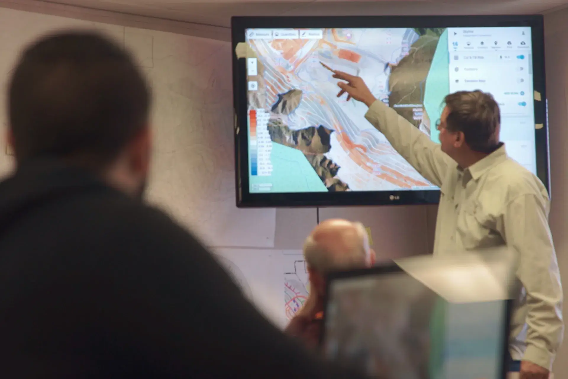
  • Cut/fill maps
  • CAD-compatible files
  • Project imagery
  • Historical scan data

Teams should also understand what happens to the data if a project closes or the subscription ends.

Export capability does not eliminate the need for specialized civil engineering or estimating tools. It prevents vendor lock-in and allows technical teams to use the data in established workflows.

Access for the Whole Project Team

Current surface data should reach the people responsible for planning, verification, and execution.

Evaluate seat limits, user roles and permissions, contractor access, field and office usability, report sharing, markup and collaboration tools, access to historical scans, and mobile availability.

A surface cannot improve coordination when only one person can view or interpret it. TraceAir’s land development platform includes cut/fill measurements, lot-level views, scan comparisons, visual collaboration, and shared project access for teams managing earthwork and site preparation.

How Should Teams Compare Mapping Vendors and Software?

Evaluate vendors using representative site data rather than a polished demonstration project. The goal is to determine whether the platform can create, validate, update, compare, and share a surface that reflects actual site conditions.

Prepare:

  • A recent existing-ground surface
  • The latest civil design
  • A site with representative terrain or vegetation
  • Original and final quantities from a completed project
  • Required file formats and accuracy standards
  • Typical reporting areas
  • A list of users who need access

Ask each vendor to explain:

  • How the site would be captured and which sensor or data source would be used
  • How the surface would be validated and documented
  • How long processing would take
  • How design revisions and updated measurements would be managed
  • Whether quantities can be reported by lot and phase
  • Which files can be exported
  • Who can access and share the data
  • What happens to the project history after the engagement ends

Use a completed project to compare the original estimate with final quantities and identify when the team first detected any discrepancy. Then assess whether more current topography, better validation, a different capture method, or more frequent measurements could have improved the decision.

To evaluate the workflow using one of your own sites, book a TraceAir demo.

Frequently Asked Questions

What is 3D topographical mapping?

3D topographical mapping creates a digital, georeferenced model of terrain elevations and surface features. Construction and land development teams use it to understand existing conditions, compare the ground with design plans, and calculate earthwork quantities.

How is 3D topographical mapping used in earthworks?

Teams compare the existing-ground surface with a proposed grading surface to calculate cut and fill. Updated mapping can also be used to track material movement, evaluate site balance, measure progress, and review conditions by lot or phase.

Is LiDAR more accurate than photogrammetry?

Neither method is automatically more accurate in every situation. Photogrammetry can perform well where the ground is visible. LiDAR is often more effective where vegetation obscures the terrain. Accuracy also depends on equipment, control, processing, flight planning, site conditions, and quality assurance.

Can drone mapping replace a licensed topographic survey?

Drone mapping can support planning, measurement, and site comparison, but it should not automatically be treated as a licensed survey. Projects that require certification, legal boundaries, or licensed survey deliverables should engage an appropriately licensed surveyor.

How frequently should an active grading site be mapped?

The appropriate frequency depends on grading speed, project risk, billing cycles, and the decisions the data must support. A team making weekly earthwork and sequencing decisions may need more frequent updates than a team using mapping only for monthly executive reporting.


Mind the Information Gap: How Project Managers Can Spend Less Time Looking for Data

2 min read

Mind the Information Gap: How Project Managers Can Spend Less Time Looking for Data

We hear it from construction teams all the time: there aren't enough hours in the day. Between problem solving, progress tracking, and dispute...

Read More
Podcast: Improving The Construction Industry With Advanced Tech

2 min read

Podcast: Improving The Construction Industry With Advanced Tech

For many years, the construction industry was slow to adapt to technology. More recently, advancements in user-friendly platforms are rapidly...
Read More
Customer Story: Arroyo Capital Reduces Costs with Virtual Site Inspections

3 min read

Customer Story: Arroyo Capital Reduces Costs with Virtual Site Inspections

As a leader in residential development, Arroyo Capital knows effective project management is essential to the success of its $2 billion real estate...

Read More