Customer Story: Century Communities Puts Dirt to Good Use
For most homebuilders, extra dirt equals extra problems. Exporting dirt is not only time-consuming, but also expensive. 500,000 cubic yards of...

3 min read
Brookfield Residential is a leading North American new home builder and land developer with one goal in mind—to create the best places to call home. From the development of award-winning master-planned communities to the design and construction of premier homes, Brookfield Residential is committed to cultivating an exceptional life experience for its customers. In their pursuit of innovative technologies, Brookfield Residential’s Southern California division began using TraceAir in 2018 on their Whittier project.
Spanning over 70 acres, Whittier was a pivotal project for Brookfield Residential and their pilot project with TraceAir. The engineers original estimate suggested a shortage of 40,000 cubic yards of fill material. TraceAir’s scans consistently indicated a shortage of 250,000 cubic yards
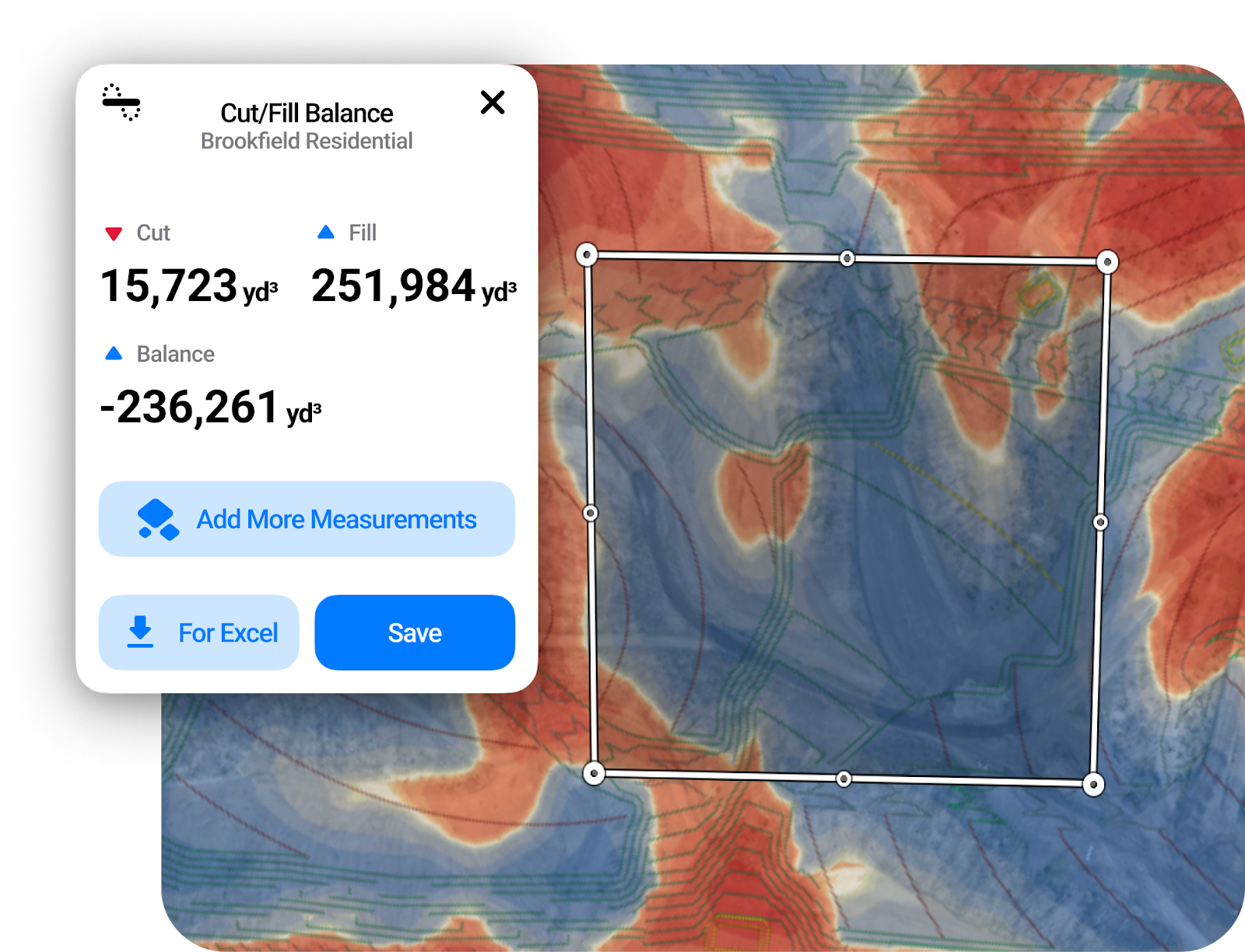
Ultimately, the grading contractor verified the calculations and confirmed that TraceAir’s data was correct. This discovery prompted them to adjust their plans, sourcing the additional 250,000 cubic yards of dirt needed to stay on schedule and within budget. The ability to cross-check estimates with data from TraceAir added an extra layer of confidence to their planning. “Using this instance as an example, we decided we needed to utilize Trace Air on more of our projects going forward,” shared Brian Mangano, Director of Regional Development at Brookfield’s Southern California Division.
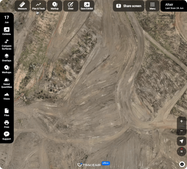
At Altair, a Brookfield Residential project in Temecula, the team faced the challenge of accurately assessing the original ground (OG) before starting grading and clearing the dense, 100-acres of brush and vegetation. Traditional methods often struggle to penetrate dense vegetation, resulting in inaccurate data.Leveraging TraceAir's cutting-edge LiDAR technology, they were able to obtain precise topographical data, ensuring that the project started with an accurate surface and projected numbers.
LiDAR, which stands for Light Detection and Ranging, is a remote sensing technology that measures distances using laser pulses. This method creates high-resolution maps of the Earth's surface, capturing precise topographical data. For Brookfield Residential’s Southern California division, LiDAR has become indispensable in ensuring the accuracy of their projects.
"I am proposing using LiDAR for all our OG topography, regardless of project size, because it is significantly more accurate and faster than other methods," Mangano emphasizes. This accuracy is crucial for precisely estimating earthwork volumes, identifying discrepancies, ensuring that project plans are based on reliable data, and avoiding costly mistakes that could lead to delays and budget overruns.
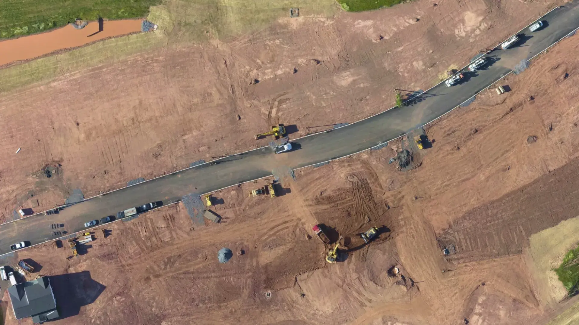
Developing in the hills of Southern California often requires extensive dirt movement, making earthwork tracking a significant challenge for developers. This is especially true for homebuilders like Brookfield Residential, who must manage multiple phases of site work alongside vertical construction. With so much happening simultaneously, managing earthworks can be difficult, resulting in an increased risk of potential delays and cost overruns.
“Incorporating TraceAir into our processes has significantly enhanced our accuracy and efficiency,” shared Mangano. “We can now assess earthwork needs more precisely from the beginning and throughout our projects. This improvement helps us account for necessary cut and fill needs, quickly identify and address discrepancies, and prevent delays and additional costs. Additionally, using TraceAir for tracking progress and quantities ensures the accuracy of the bills we receive.”
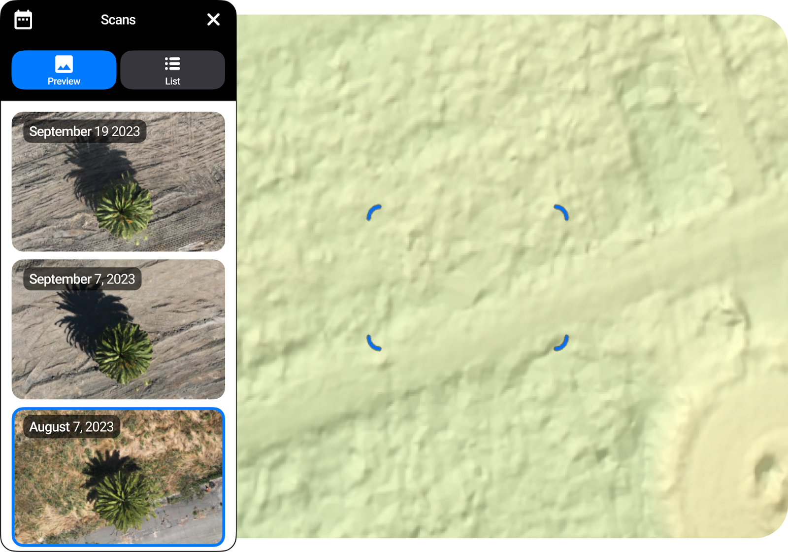
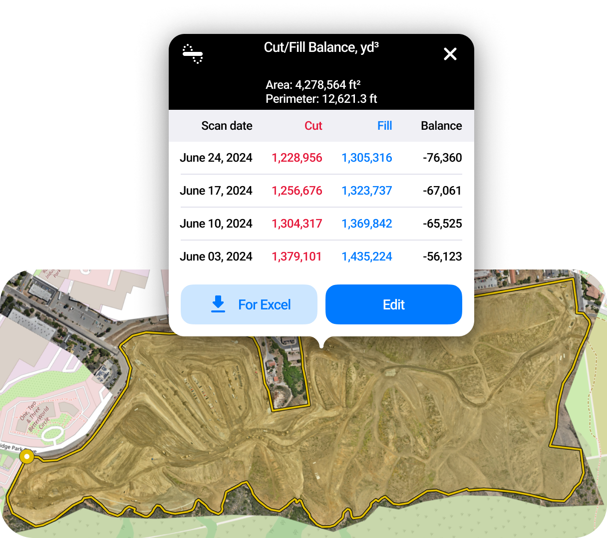
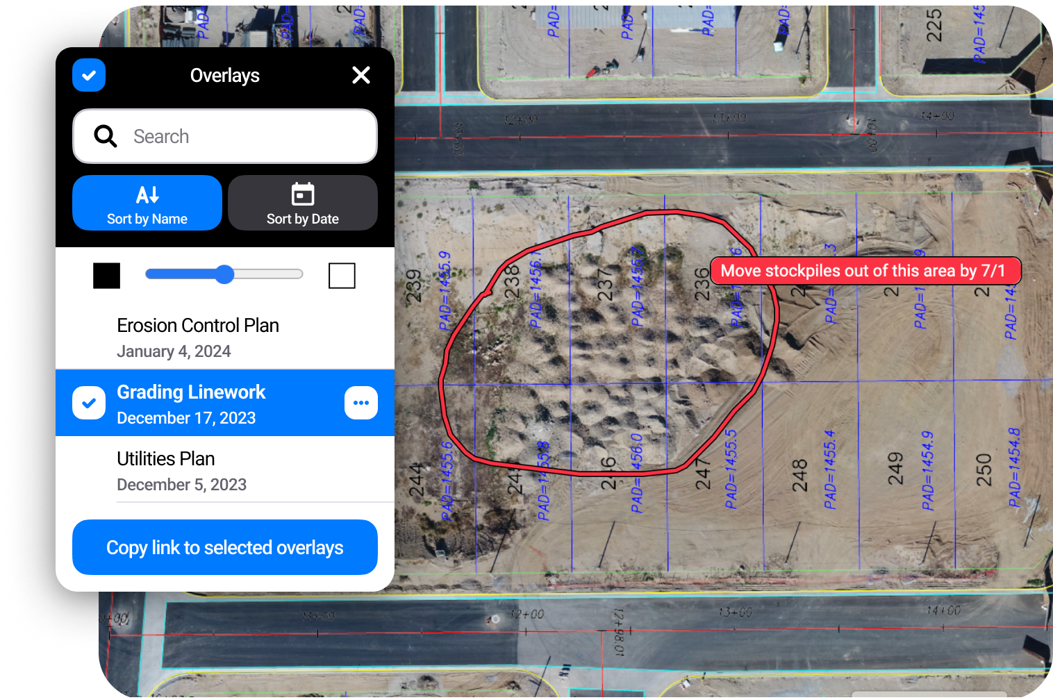
TraceAir’s platform allows for quick measurement of cut and fill volumes across the entire site, down to individual lots, with an accuracy of up to 1/10' (3 cm). Colored heat maps provide a visual representation of earthworks quantities, making it easy to identify areas needing cut or fill. This tool enhances the efficiency of achieving site balance, eliminates unnecessary dirt handling, and ensures optimal resource allocation. The ability to toggle between scans to see movement over time further improves project management and decision-making.
Utilizing TraceAir's unlimited licenses, Brookfield Residential’s Southern California division ensures that every team member and contractor can access the platform without restriction, providing everyone with tools and data to make faster and smarter decisions.
“Implementing TraceAir has improved the way our team collaborates,” shared Mangano. “We provide access to all our contractors and review the platform in every meeting to keep everyone on the same page. This unified approach significantly reduces miscommunications and ensures that all stakeholders are continuously informed and aligned. It fosters a collaborative and informed working environment that reduces the risk of errors and enhances overall project development.”
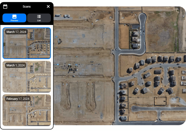
Brookfield Residential’s Southern California division has projects and teams spread out over a wide area, so having TraceAir to keep everyone aligned is crucial. “Our entire team appreciates the weekly progress updates from TraceAir. The aerial photos and 360-degree panoramas are great for visual updates, and the additional insights help us avoid issues and discover ways to be more efficient,” said Mangano.
Brookfield Residential’s Southern California division’s partnership with TraceAir has revolutionized their approach to land development, enhancing precision, efficiency, and collaboration across their projects. From managing earthworks to empowering their team with actionable data, the benefits of TraceAir’s technology are clear.
If you're ready to see how TraceAir can transform your projects with unparalleled accuracy and efficiency, schedule a demo today. Discover the difference that cutting-edge technology and a commitment to excellence can make for your team.
For most homebuilders, extra dirt equals extra problems. Exporting dirt is not only time-consuming, but also expensive. 500,000 cubic yards of...
Land development teams do not just need to know that work is happening. They need to know whether the right work is happening, in the right place,...
2 min read
As the largest privately-held homebuilder in the Philadelphia, Pennsylvania region, W.B. Homes knows effective project management is vital to their...