

Stormwater Drainage & Slope Reports
See where water will pool, before it rains.
Every drone scan becomes a depth-mapped view of your site — surfacing closed depressions, detecting slope compliance, and any deviation from design grade. Built for proactive planning, faster issue resolution, and smoother coordination.
Closed Depressions Report
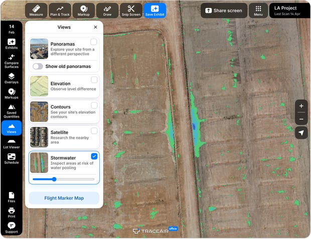
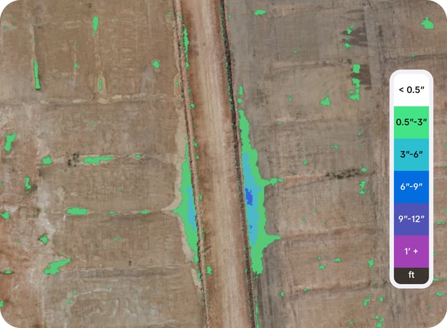
Every low spot on the site, ranked by how deep the water gets.
The Closed Depressions Report is a powerful visual tool that pinpoints low areas with no natural outlets or installed drainage, where stormwater is likely to accumulate. Color-coded by depth, this report offers a quick, intuitive overview of flood risks, clearly highlighting areas that may need further attention.
- Depth-based heat map across the whole site, not just where someone thought to look
- Useful at rough grade, during utilities, and after vertical construction
- Scan across your entire portfolio to triage risk before the next storm
Slope Reports
Slope compliance on every lot, without walking any of them.
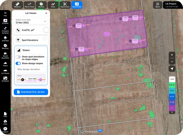
The Slope Report measures gradients along the trajectories that actually matter on your site: lot boundaries, pad to front of lot, front of lot to curb, driveways and roads. Actual slope sits next to design slope, with direction arrows — because a driveway at the right gradient in the wrong direction is still a problem.
- Measurement trajectories configured per project to ensure individual HOA slope compliance
- Spot elevations at lot corners, pad corners, or center against design grade
- Download every lot as an Excel report for contractors who are not in TraceAir
Lot Viewer
Find the lots out of tolerance, then build the punch list.
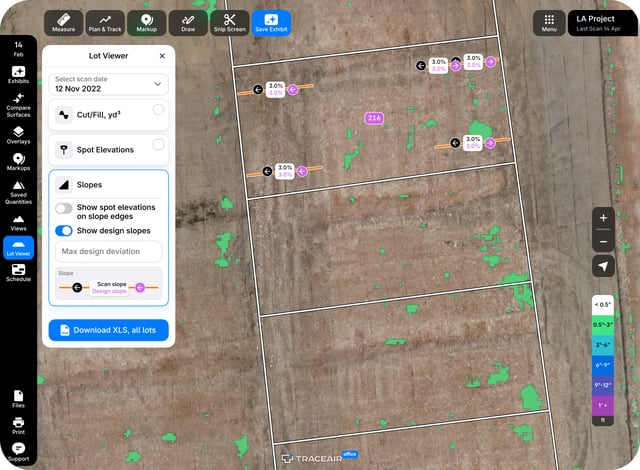
Click into any lot for its slopes, cut and fill balance, and spot elevations against design. Flag what is wrong, save the view as an interactive exhibit with your comments, and send it to the contractor who has to fix it. When the next scan lands, switch surfaces and confirm it actually got fixed.
- Cut and fill balance, slope, and spot elevation measured per lot, in cubic yards
- Custom filters to isolate the lots that still need work to better manage resources and contractor time
- Interactive exhibits with commenting and markups, shareable with anyone