


2 min read
The Real Cost of Surveying: How Drones Save Time and Money
How often do you survey your project? If cost were no issue, how often would you survey your project? Monthly? Weekly? Does that align with your...





4 min read
A drone scan captures a site's current conditions. It helps teams review terrain, check progress against plans, and catch issues before they turn into field delays. What it does not do is stand in for a licensed survey.
That distinction matters the moment a title company, lender, agency, or recording requirement calls for a surveyor-certified document. Teams lean on aerial data early for planning and due diligence, then discover late that a closing, permit, plat, or finished-lot certification depends on a licensed survey nobody has ordered yet.
TraceAir provides ALTA and topographic surveys in select states, performed with a state-licensed surveyor partner. For builders and developers, that means the aerial data guiding early decisions and the certified survey work required later can be planned together, so the survey arrives as a scheduled milestone instead of a blocker.
Aerial data earns its place early in due diligence. Before an engineer sets a design grade, it can reveal existing structures, trenches hidden in vegetation, surface debris, and other conditions that change how a parcel pencils out.
On heavily wooded parcels, LiDAR captures true ground elevation through vegetation, giving teams a read on contours where photogrammetry alone falls short.
That data gets more useful once it connects to tools built for site decisions. Within TraceAir, Overlays compare current conditions against design plans or historical data. Lot Viewer flags lots that fall outside design-grade tolerance with color-coded maps.
Cut/fill tools quantify earthwork before crews mobilize. Measurement tools size pipe runs, fence lines, amenity areas, and retention pond slopes.
Used this way, aerial data gives teams rapid site visibility and the context to spot problems while there is still room to act.
“A big part of my role is to discover any issues with the project before it starts and throughout. TraceAir helps me assess potential challenges related to grading, utilities, SWPPP, permits, and other regulatory compliances. The aerial imagery and tools within TraceAir allow me to do a much more thorough assessment than I could by walking a project.”
Robert Fitzgerald, Entitlements Analyst for D.R. Horton’s West Central Florida Division.
A drone scan and a licensed survey are not interchangeable. Aerial data can inform planning and site analysis, but it is not a certified survey and should not be treated as one when a certified document is required.
That requirement tends to surface at specific moments:
Aerial data helps teams make better decisions. A licensed survey provides the professional certification another party needs when they require a surveyor-signed document.
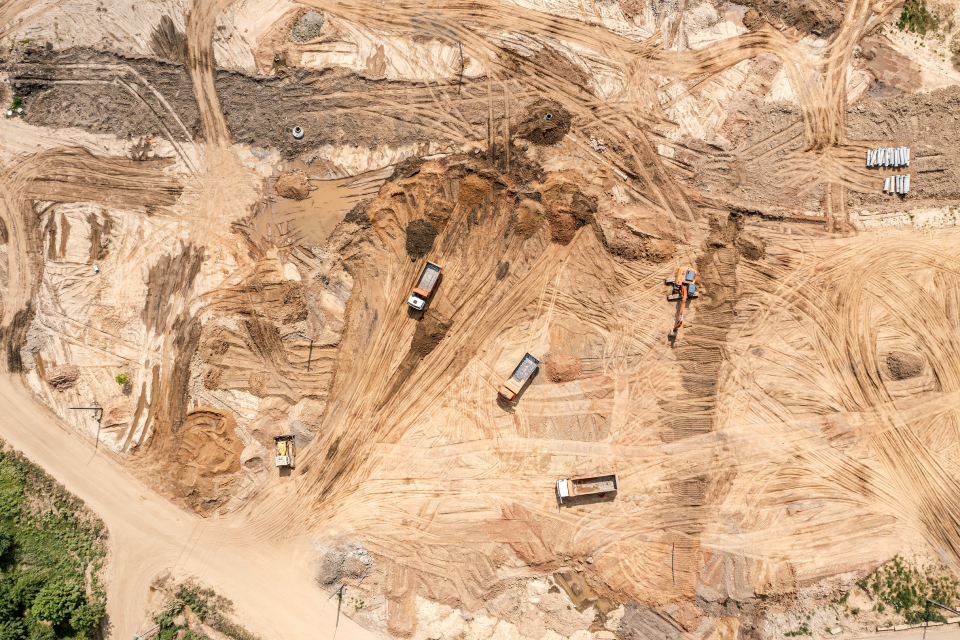
Timing is where teams lose ground. A certified survey ordered after a closing date is set or a permit window opens becomes the item everything else waits on. Teams avoid that scramble by identifying survey needs at the start of a project and mapping each deliverable to the milestone it serves.
Survey needs change as a project moves from acquisition through design, construction, and closeout. Before acquisition or closing, an ALTA survey documents boundaries, easements, improvements, and access.
During planning and design, a topographic survey gives engineers the contours and surface conditions they work from. Later, pad certification or final line and grade documentation confirms that finished lots match the approved grading plan.
The work ahead of each milestone is where early site intelligence pays off. For land acquisition and pre-development teams, Layout Generator tests subdivision layouts, estimates lot yield, and compares site options, which helps a team judge whether a parcel is worth deeper review before committing to engineering or survey coordination.
On wooded or complex sites, LiDAR shows existing conditions that support cut/fill analysis and early conversations with engineering and survey partners.
By the time a certified document is due, the team has more than a deadline. It already knows the site conditions and the open concerns, and it knows where the survey fits in the schedule. The survey still satisfies the requirement. The difference is the team is ready for it.
Licensed surveys matter at the moments a project needs certified documentation. The mistake is waiting until that requirement is already blocking a closing, permit, certification, or handover.
Working from aerial data earlier gives land and development teams a clearer view of existing conditions before the survey milestone arrives, which leads to sharper questions for engineering and survey partners and fewer late surprises.
See where ALTA, topographic, and pad certification work fits your next project.
No. A drone scan gives teams fast visibility into current site conditions, terrain, progress, and potential issues. A licensed survey is a certified document prepared for formal requirements such as title, lender, agency, plat, or grading documentation.
A drone scan is useful early in due diligence, planning, and construction monitoring. It helps teams compare existing conditions against plans, identify grading or access concerns, and understand which areas need closer review before formal survey work is requested.
An ALTA survey is commonly used before acquisition or closing, when teams need documentation of boundaries, easements, improvements, access, and other property conditions that may affect the deal or the title process.
LiDAR captures ground elevation through vegetation, which is useful on wooded or complex parcels. That terrain context helps teams understand contours, evaluate site conditions, and prepare better questions for engineering, survey, and field teams.
TraceAir gives teams a clearer record of site conditions before a certified document is needed. Overlays, cut/fill tools, Lot Viewer, LiDAR, and measurements help teams identify known concerns and understand where a survey milestone fits the broader schedule.
Identify likely survey needs early. Map ALTA, topographic, pad certification, and final line and grade requirements against acquisition, design, construction, and closeout milestones so the survey does not become a late blocker.

2 min read
How often do you survey your project? If cost were no issue, how often would you survey your project? Monthly? Weekly? Does that align with your...
1 min read
Road work is moving toward tech Until around five years ago, road design and construction rarely used any form of digitization or analytics, but...
1 min read
TraceAir Surveying Inc., a subsidiary of TraceAir Technologies, Inc., is thrilled to now offer flight marker placement and maintenance in select...