1 min read
Verifying As Builts with TraceAir
Time is of the essence in any construction project, so when you get the call from the contractors that the lots are complete, it’s great news! You...

2 min read
By now, you know that TraceAir is a powerful and proven solution for homebuilders and land developers to achieve site balance, track progress, and stay on schedule. But you may not know that there are also many benefits for marketing teams.
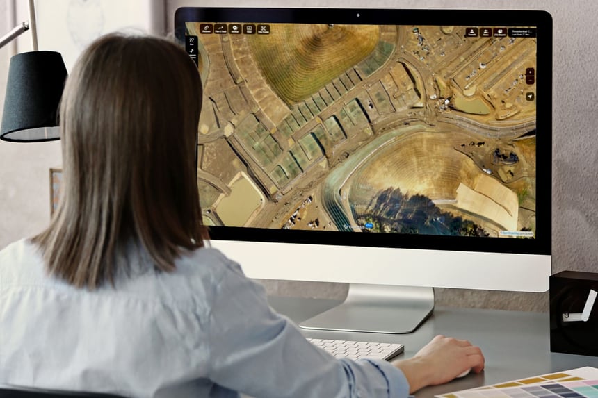
Marketing teams typically don't get to visit project sites as often as they'd like. They often rely on others for progress updates. With TraceAir's cloud-based platform, marketing teams can stay updated on progress and use the aerial images and data for marketing efforts.
TraceAir provides unlimited licenses to our users so that everyone involved with a project can access project data and images. When we say everyone can benefit from using TraceAir, we mean everyone — project managers, stakeholders, contractors, and even marketing teams.
Even the marketing team at W.B. Homes likes to check out the high-resolution 3D scans and the progress of projects within TraceAir. With everyone having access to the data, users can find the answers they need without having to wait for subcontractors or surveyors, saving valuable time and money.”
— Steve Schaffer, Director of Land Development, W.B. Homes
The high-quality 360° panoramic images captured by TraceAir are perfect to show in meetings, use on your website or social media, and provide progress updates. Viewers can rotate in a full 360° and zoom in and out, allowing them to experience your project as if they were on-site.
These images can be easily shared or embedded, requiring no downloads or logins. Anyone with the link can experience 360° views of your projects from a desktop, tablet, or smartphone. To obtain shareable 360° links, simply select “copy link to share” after selecting 360° on your project.
We share our 360° panoramic images from TraceAir with current and future residents of our communities to keep everyone informed of progress.”
— Stacia Bloom, Land Development Manager, Century Communities
Websites, social media, printed collateral, trade shows — marketing teams always need high-resolution images. Our premium scans are captured at lower altitudes during your regular flyover for extra high-quality images. Users can have premium scans conducted every flight or for special occasions, such as:
How often are you asked about the progress of a project, or “how much longer” a community will take to complete? Stakeholders, project managers, and future homeowners are always eager to see progress. However, site visits and still photos often do not do justice to how much progress has actually been made, especially during the site work phase.
Time lapses are a super effective and cool way to showcase progress. TraceAir’s time machine feature houses all your scans, making it easy for users to visually compare progress in a given area over time. Use the snip screen or print tool to export screenshots of your progress, and piece them together in video software to create time-lapses.
With so many use cases for marketing teams to utilize the data and images from TraceAir, providing your team with access is a no-brainer. For help providing access or to learn more about using TraceAir on your projects, schedule a demo with our team.
1 min read
Time is of the essence in any construction project, so when you get the call from the contractors that the lots are complete, it’s great news! You...
3 min read
Are you experiencing staffing challenges? You’re not alone. Although the need for new buildings — such as residential homes, master-planned...
3 min read
Despite an increase of 77% from last year, the number of lots available for residential building in the US remains “significantly undersupplied”,...