1 min read

Small Issues Add Up: Why Land Development Managers Need Site Intelligence Software

Small Issues Add Up: Why Land Development Managers Need Site Intelligence Software
TraceAir | Small Issues Add Up: Why Land Development Managers Need Site Intelligence Software
2:32

Empowering Land Development Managers‍

Land development projects leave little room for budget errors, and small problems can add up to huge headaches for project management. Land Development and Project Managers are forced to rely on engineers, surveyors, and contractors to get the answers they need because they lack the necessary tools to obtain accurate data so they can make decisions.

The investment in site intelligence software is easily embraced on large projects, but the cost can be prohibitive on small developments. Let's explore how investing in these tools can help with some common critical business issues (and save money!) on smaller projects.

Solving Site Balance Issues‍

Site balance calculation errors can add up to big expenses, like this customer of ours recently explained. This twelve-acre residential development began site development prior to their implementation of TraceAir, and unfortunately the engineer's estimate of required dirt imports was short by 12,000 cubic yards. Using regular drone flyovers and site intelligence software could have easily prevented this error.

TraceAir's 3D topographical maps and software allow for accurate cut/fill balance measurements as compared to design grade. Having TraceAir at the start of the project could have prevented this miscalculation and saved the owner approximately $7,000 in dirt import costs, which more than covered the cost of drone flights and software on this project!

Keeping Stakeholders Happy‍

Stakeholder communication is a constant issue for Land Development and Project Managers. On a mixed-use development in San Francisco, the development team was tasked with managing multiple stakeholders. Prior to using site intelligence software, the team tried to explain complex construction concepts using CAD files of construction plans as visuals, which were cumbersome and difficult to understand for non-technical professionals. To better communicate with stakeholders, the developer implemented TraceAir.

Using TraceAir's platform made it easy to explain difficult concepts using regularly-captured images overlaid with construction documents. This enabled them to present accurate, easy-to-understand visuals to their stakeholders. Meetings ran much more quickly, and TraceAir helped to minimize the amount of back and forth communication between the developer, contractor, and other project stakeholders.

Overcoming Lot Supply Shortages with TraceAir’s Competitive Advantage

3 min read

Overcoming Lot Supply Shortages with TraceAir’s Competitive Advantage

Land acquisition teams across the country are in desperate search of lots to build on. The first quarter of the year has seen a significant...
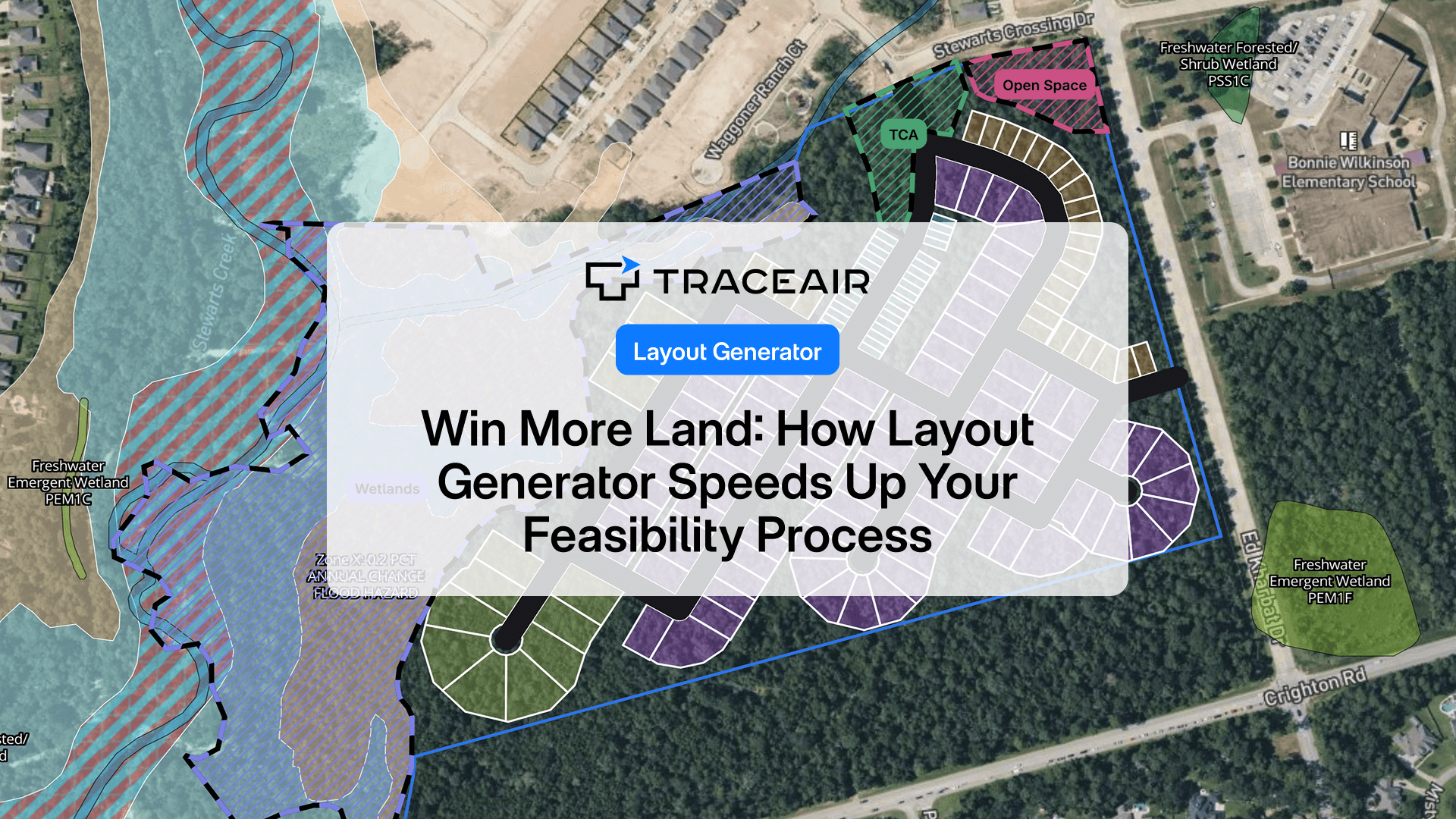
Read More
3 of the Hottest Trends in Master-Planned Communities

2 min read

3 of the Hottest Trends in Master-Planned Communities

No longer for just retirees, the rising demand for more housing has fueled the fire for master-planned communities. These large developments have...

Read More
How TraceAir Delivers Site Intelligence on Mega Projects

2 min read

How TraceAir Delivers Site Intelligence on Mega Projects

TraceAir serves a variety of project types and sizes that range from less than 3-acre school campuses to master planned communities that span over...

Read More