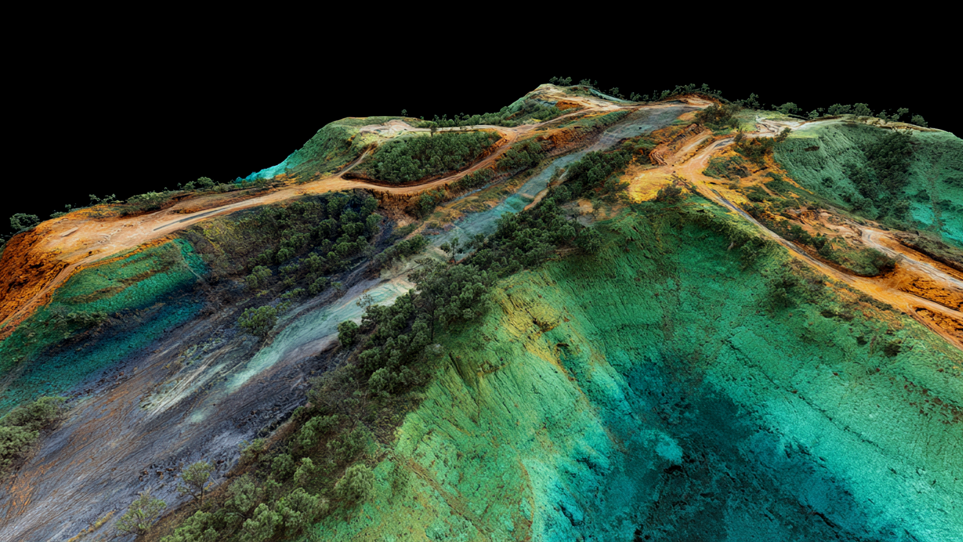
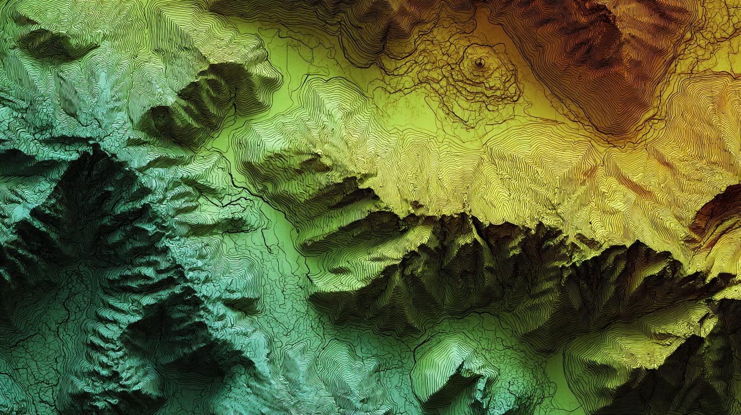
When projects are under pressure to move fast—from construction to disaster response—waiting weeks for topographic data just doesn’t cut it. That’s why more teams are turning to LiDAR—a powerful technology that uses drone-mounted lasers to capture accurate topography, even through thick vegetation or in areas where traditional surveys fall short.
What sets LiDAR apart isn’t just precision—it’s speed. Instead of waiting weeks for data, teams get fast, actionable insights they can use to move projects forward with confidence.
Here are seven industries where LiDAR is changing the game—and how fast, reliable site data is helping them work smarter, not harder.
1. Oil & Gas
Plan smarter access and pipeline routes in complex terrain.
Oil and gas companies rely on detailed terrain analysis to lay out infrastructure like pipelines, well pads, and access roads. In remote areas with thick vegetation or limited access, ground surveys are often too slow, costly, or unsafe. LiDAR solves that by delivering clear, accurate terrain data fast—helping teams select optimal routes, assess slope and stability, and streamline permitting with clean baseline data.
The ability to scan vast areas from the air—with no boots on the ground—makes LiDAR indispensable for upstream planning and midstream design.
2. Construction & Infrastructure
Accelerate preconstruction with verified site conditions—and make more informed decisions.
Major civil projects like highways, airports, and utilities depend on timely, high-accuracy topographic data to plan earthwork, forecast quantities, and manage budgets. LiDAR provides the precision needed to perform cut/fill analysis, model drainage paths, and align design work with real-world conditions.
By using LiDAR ahead of mobilization, construction firms can reduce change orders, avoid rework, and maintain tighter control over schedules and costs. It’s especially useful in early-stage feasibility studies, bid modeling, and value engineering exercises—helping teams make more informed, data-backed decisions from the start.
3. Disaster Response & Recovery
Respond faster and rebuild smarter after major events.
After wildfires, floods, hurricanes, or landslides, LiDAR offers rapid insight into how terrain has shifted, long before field teams can safely access a site. Emergency response agencies and engineers use LiDAR to evaluate damage, prioritize recovery efforts, and monitor changes to slope stability and hydrology.
In high-stakes scenarios where time and safety matter most, LiDAR enables fast, informed action based on objective surface data, supporting everything from federal relief assessments to local reconstruction plans.
4. Industrial Development
Avoid costly surprises before breaking ground.
From manufacturing plants to distribution centers, industrial projects require flat, stable, buildable land. But assumptions based on old maps or incomplete surveys can lead to grading surprises and budget overruns. LiDAR eliminates the unknowns by providing a clear picture of site conditions up front, so development teams can make smarter site selection, design, and grading decisions.
With LiDAR, developers can understand slope, model cut/fill, and visualize stormwater flow before spending a dime on design or mobilization.
5. Agriculture
Use elevation insights to improve planning and yields.
Farmers and agtech consultants use LiDAR to better understand how elevation and slope impact planting, irrigation, and runoff. High-resolution topographic maps help identify erosion risk, drainage inefficiencies, and uneven terrain that can affect yields.
For large-scale farming operations, LiDAR offers a cost-effective way to model entire fields at once, supporting smarter crop planning, field improvements, and conservation strategies.
6. Energy & Transmission
Streamline site selection and right-of-way analysis.
Utility providers and renewable energy developers rely on LiDAR to scout locations for solar farms, wind turbines, substations, and transmission lines. With the ability to map terrain, tree canopy, and ground elevation across long corridors, LiDAR helps simplify routing, permitting, and vegetation clearance.
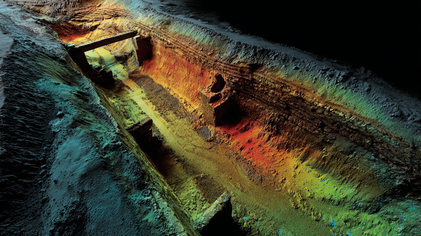
It’s especially valuable when time is tight, environmental compliance is complex, and line-of-sight data is critical for infrastructure design. LiDAR is also highly effective at measuring the depth of deep excavations—an essential need for underground utilities and other complex infrastructure work.
7. Land Development & Homebuilding
Eliminate grading guesswork and uncover site risks earlier.
For land developers and homebuilders, time is everything. LiDAR provides a fast, affordable way to capture original ground surface—even under dense vegetation—before the first contractor walks the site. That means better grading estimates, earlier dirt balance modeling, and fewer change orders. With accurate cut/fill data in hand from day one, teams can model feasibility, reduce hauling costs, and avoid delays tied to unclear topography.
Whether you're acquiring a new parcel, navigating entitlements, or modeling preliminary layouts, LiDAR enables smarter decisions, weeks earlier than traditional survey workflows.
TraceAir Makes LiDAR Simple—And Fast
TraceAir delivers the LiDAR data you need—without delays, complexity, or extra coordination.
From site flight to final files, we manage the entire process so your team doesn’t have to. In just 3 business days, you get clean, vegetation-free elevation data that’s ready to use in grading plans, feasibility studies, and layout design. No chasing vendors. No waiting weeks. Just fast, accurate insights—delivered the way modern teams and time-sensitive proejcts need.
Why Teams Choose TraceAir for LiDAR
- Fast turnaround: delivered in 3 business days
- Clean, vegetation-stripped elevation data
- Built for grading, feasibility, and layout planning
- Certified deliverables available in most states*
- Scalable for any site, any sector
- Easy to request, simple to use—no extra coordination required
Get the right data, right away. Request your LiDAR scan today.