1 min read
Why Calculating Site Balance is Such a Challenge
Calculating site balance is complicated! Site balance has one of the biggest impacts on a project's budget and schedule, yet it's one of the most...

4 min read
Land acquisition is one of the most critical and complex phases in real estate development. It's fast-paced, competitive, and full of unknowns. Teams are expected to evaluate parcels, estimate development costs, flag risks, and make strategic decisions—all before someone else makes an offer.
But when you're working with outdated data, fragmented processes, and limited visibility, it’s easy to lose momentum—or make the wrong call entirely.
Across the U.S. and Canada, acquisition teams consistently face similar roadblocks that slow down decisions and add uncertainty to the deal-making process. Here are 10 of the most common challenges—and what’s needed to help teams work faster and more confidently.
At the earliest stage, teams are scanning for promising parcels that align with their product type and density goals. However, without fast access to zoning, overlays, and layout potential, it is challenging to evaluate opportunities quickly and consistently.
Why it matters: If you can’t qualify land fast, you can’t build a reliable pipeline.
What’s needed: Standardized zoning overlays and quick-turn conceptual layouts tailored to division-level requirements.
Before submitting a Letter of Intent (LOI), acquisition teams need a rough estimate of the cost to bring the site to market. But early on, access to detailed site data is limited—making it risky to rely only on rough guesses.
Why it matters: Overbidding kills margins. Underbidding means losing the deal, or bidding blind without a clear understanding of true costs.
What’s needed: Early estimates should be built using public GIS data, Land Data overlays, conceptual layouts, and quantity takeoffs—giving teams a faster, smarter way to price deals without full site access. Once under contract, a detailed topographic survey can validate and refine assumptions during due diligence.
Even when a site looks promising, the permitting path can be unpredictable. Different municipalities have different requirements, and delays in approvals can blow up timelines.
Why it matters: Long permitting cycles lead to high holding costs and missed delivery targets.
What’s needed: Early visibility into jurisdictional permitting requirements and tools to map regulatory overlays during site selection.
Entitlements can shift based on changing regulations or local politics. Zoning changes, density caps, and new conditions of approval can surface late and derail a deal.
Why it matters: What looks like a go early on might not pencil out once entitlement complexity is revealed.
What’s needed: A way to document, monitor, and flag entitlement-related risks and assumptions early in the evaluation process.
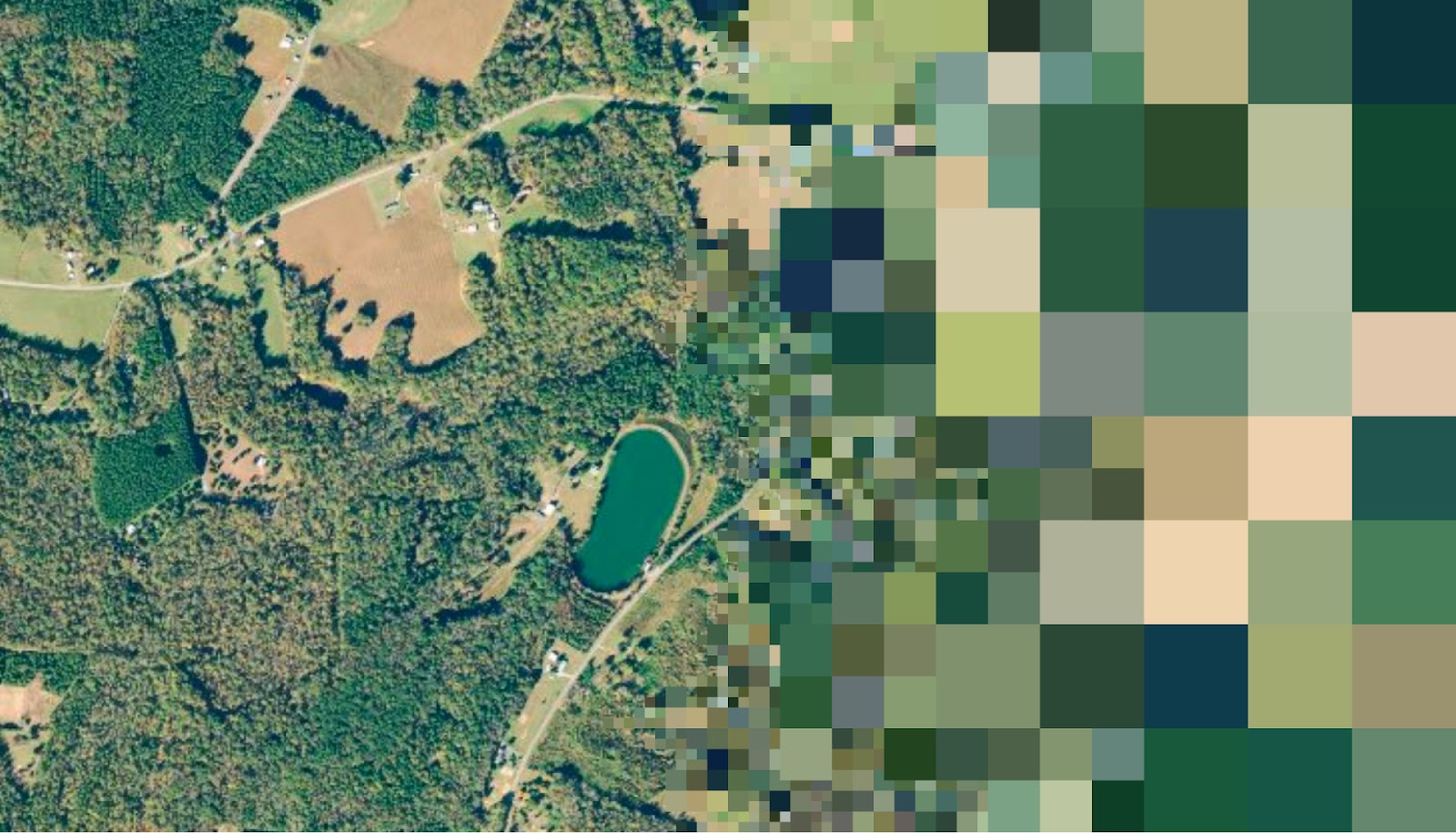
Many teams rely on public sources for topography or GIS data during early evaluation and preliminary engineering, but this data is often outdated, misaligned, or too low-resolution. While it can support initial analyses, more detailed data is necessary for preliminary design and budgeting during due diligence.
Why it matters: Decisions made based on inaccurate data can lead to budget overruns, schedule delays, and rework.
What’s needed: Recent, high-accuracy, geo-referenced topographic data—ideally LiDAR-based—that’s fast to access and simple to integrate into workflows.
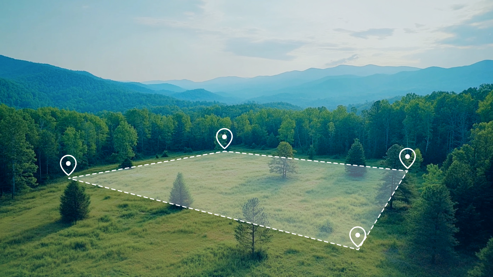
Determining lot yield is one of the most basic—but time-consuming—parts of parcel evaluation. It often requires consultants or land planners who may take weeks to deliver a preliminary plan, relying heavily on hand-drawn iterations that are slow, hard to edit, and often lack precision.
Why it matters: Without a fast, accurate way to test lot fits, good parcels can be lost—not just passed over—because teams don’t have enough time to fully evaluate and bid competitively.
What’s needed: Editable, digital conceptual layouts that incorporate local zoning, product standards, and setbacks to produce quick, reliable yield estimates—and allow fast adjustments as needed.
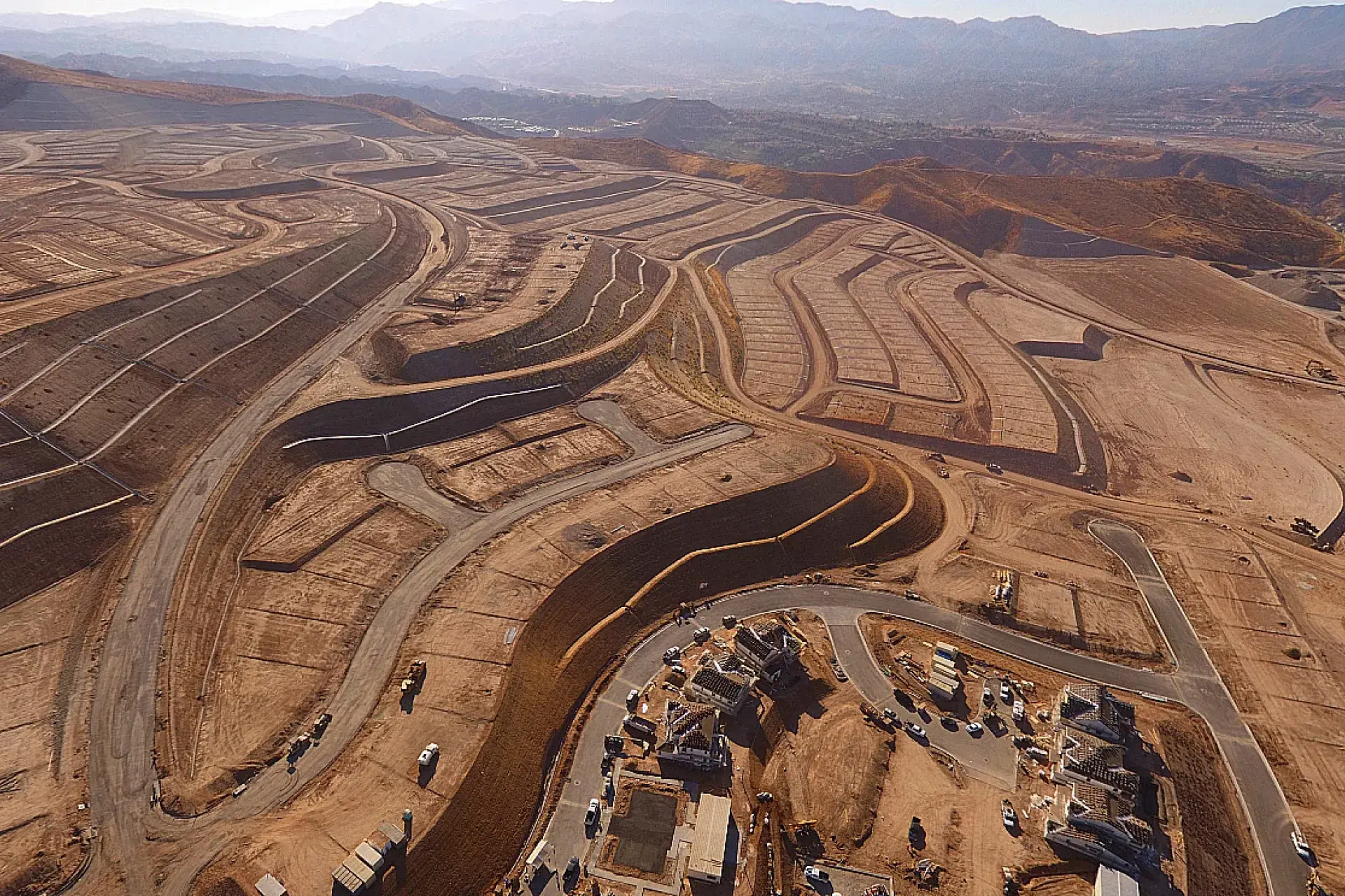
Grading is often the largest cost line in land development. But without reliable elevation models and early earthwork analysis, it’s difficult to predict if a site will balance or require costly import or export.
Why it matters: Missing on grading costs can destroy deal feasibility and corporate approval.
What’s needed: Accurate elevation surfaces paired with tools for early-stage cut/fill analysis to help teams identify red flags before engineering starts.
The best land doesn’t stay on the market long. If teams can’t evaluate a site and make a move in a matter of hours or days, they’re out of the running.
Why it matters: Speed is a competitive advantage. Delays = missed deals.
What’s needed: A consistent, rapid evaluation workflow that includes zoning, layout, and grading inputs to support go/no-go decisions under pressure.
Land acquisition, development, construction, and executive teams often operate in different systems. This creates friction when reviewing, marking up, or sharing data across departments.
Why it matters: Misalignment slows down decision-making and increases the risk of errors and oversights.
What’s needed: A centralized, easy-to-access workspace where teams can collaborate in real time and stay aligned throughout the land pipeline.
When a deal progresses, full surveys and studies are required. But traditional ALTA, topo, and environmental reports can take weeks and cost thousands, delaying the process and increasing acquisition spend.
Why it matters: If due diligence takes too long or costs too much, your competitive edge disappears.
What’s needed: Affordable, fast-turnaround surveys and certified topographic data that teams can trust—and reuse later in development.
We’ve spent years working alongside developers, land teams, and builders to understand the challenges that hold deals back. And now, we’re building something new—something specifically for land acquisition teams.
Whether you're estimating costs, qualifying parcels, or trying to stay ahead of the competition, we’re working on tools that will help you move faster, reduce risk, and make smarter decisions from day one.
Be the first to see what’s coming. Sign up now for early access and exclusive updates.
1 min read
Calculating site balance is complicated! Site balance has one of the biggest impacts on a project's budget and schedule, yet it's one of the most...

3 min read
When projects are under pressure to move fast—from construction to disaster response—waiting weeks for topographic data just doesn’t cut it. That’s...

2 min read
There's a reason why builders say that site work is 10% of the budget, but 100% of the headaches. This phase of construction carries a multitude of...