Customer Story

October 25, 2021

Customer Story: Arroyo Capital Reduces Costs with Virtual Site Inspections

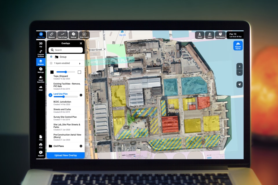
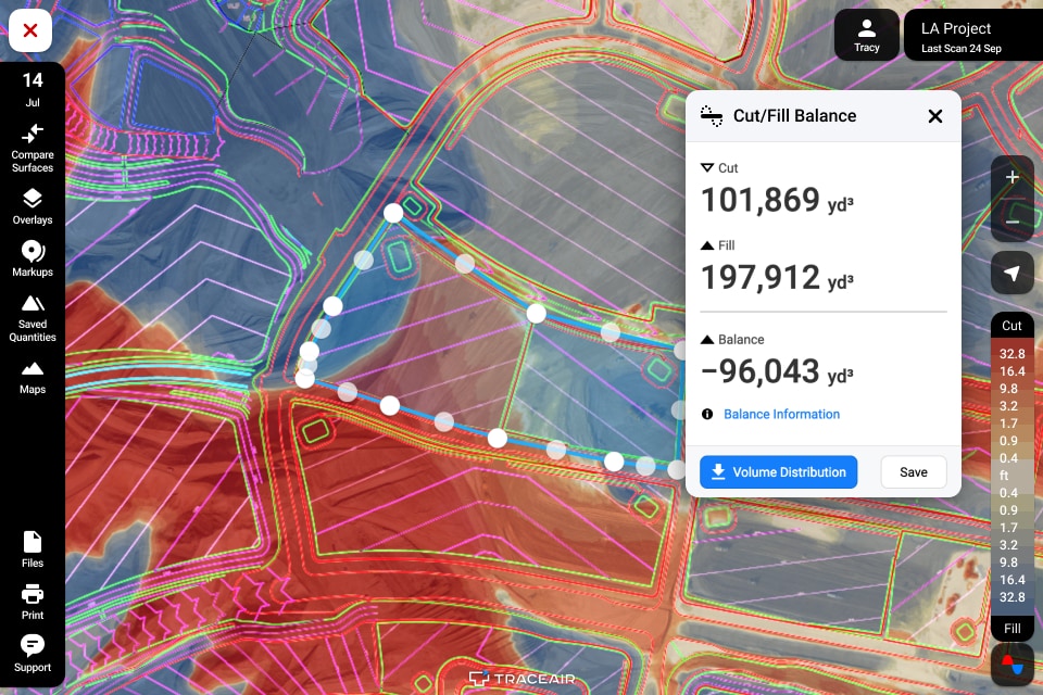
Using drones and 3D mapping software allows Arroyo Capital to cut down on travel costs, mitigate against market risk, and manage their portfolio efficiently.

Read More
June 10, 2021

How Our Customer Saved $54,000 on a Single Change Order

TraceAir provides easily accessible data that enables teams to verify change orders without additional consultants.

Read More
May 17, 2021

Customer Story: Toll Brothers Portland Makes Cost Saving Decisions with TraceAir

TraceAir empowers Land Development Managers with the right information to solve problems quickly.

Read More
May 14, 2021

Customer Story: Independent Construction Improves Margins with TraceAir

Site intelligence software helps grading contractors operate more efficiently and stay on schedule.

Read More
April 1, 2021

Customer Story: Shea Homes Uses TraceAir for Seamless Project Management

Collaboration on multiple projects with multiple stakeholders is time consuming. TraceAir makes project management and communication faster and more productive.

Read More
October 8, 2020

Customer Story: Stakeholder Communication at Pier 70

TraceAir's web-based platform, high-resolution topographical images, and easy-to-use tools allow project teams to easily communicate between stakeholders, promoting faster decision making.

Read More
August 13, 2020

Customer Story: Tracking Contaminated Soil Quantities

TraceAir's web-based platform, accurate measurement tools, and high-resolution aerial images allow teams to easily measure and track material quantities on their projects.

Read More
August 6, 2020

Customer Story: Billing Transparency Between a GC, Owner, and Subcontractor

TraceAir's web-based platform, accurate measurement tools, and high-resolution aerial images allow general contractors to verify billing quantities quickly and easily.

Read More
July 27, 2020

Customer Story: Tracking Stockpiles and Preventing Rework Results in Cost Savings

TraceAir's web-based platform and high-resolution aerial images allow teams to measure accurate stockpiles and use project document overlays to prevent expensive rework.

Read More
July 9, 2020

Customer Story: Site Balance Solutions

TraceAir's user-friendly site balance tools and high-resolution aerial images enabled Brookfield Properties to quickly validate reimbursable costs of soil generated on site.

Read More
June 19, 2020

Customer Story: Tracking Progress Remotely

TraceAir's web-based platform and high-resolution aerial images allow project leadership to track site development progress from any location.

Read More

Get the latest news from TraceAir