1 min read

Four Reasons Road Projects Need Site Analytics

Four Reasons Road Projects Need Site Analytics
TraceAir | Four Reasons Road Projects Need Site Analytics
2:42

Road work is moving toward tech

Until around five years ago, road design and construction rarely used any form of digitization or analytics, but these technologies will significantly affect road design and construction in the near future.”

Source: McKinsey & Company

While hard bid, lump sum road work projects seem cut and dry, they are liable to the same issues that plague more complex projects: inaccurate, outdated survey data, dirt balance issues, change orders, disputes, etc. The "back of the napkin" estimates provided by public agencies put projects at risk of budget overruns and schedule delays. Both contractors and agencies benefit from frequent, accurate project data and easy-to-use software. Here's how:

1. Surveying‍

If projects don't have accurate data from the start, it sets them up for issues down the road (pun intended!). Drones capture topographical data quickly and inexpensively, so project teams don't have to rely on outdated information. Overlaying design documentation with the topo provides an accurate visual of the project so there's no guessing whether the built environment matches what was designed. Frequently capturing drone surveys throughout the project means survey information is never outdated, and any construction errors are noticed right away.

3. Progress Tracking and Billing‍

Similar to material tracking, contractor billing also relies on inaccurate truck counts, which can often lead to disputes over whether billing matches the work put in place. Using current 3D topos and analytics software makes it easy for contractors and agencies to track progress by measuring the amount of dirt moved, utilities put in place, and roadway paved, which ensures more accurate billing. Additionally this benefits contractors, because accurate billing reduces disputes and results in faster payment.

4. Stakeholder Communication‍

Given the remote location of many road work projects, software allows agencies and other project stakeholders the ability to visualize the project remotely, saving time consuming trips to the project site. Contractors and agencies can collaborate in the platform to discuss challenges with a maneuverable visual aid, which makes communication between stakeholders much more productive during meetings.

The future of road construction is here! ‍

Contractors and public agencies are continuing to embrace technology and analytics on road construction projects to improve project management, make better decisions, and stay on budget and schedule. To learn more about how to get started with site intelligence software, contact our team.

How North Carolina Builders Are Reducing Entitlement Risk and Site Delays

2 min read

How North Carolina Builders Are Reducing Entitlement Risk and Site Delays

North Carolina is currently experiencing one of the fastest-growing housing markets in the US, fueled by a robust economy, an influx of new...

Read More
The Rental Revolution: Overcoming Challenges in the Build-to-Rent Market

2 min read

The Rental Revolution: Overcoming Challenges in the Build-to-Rent Market

The real estate market has witnessed a significant transformation in recent years, with the emergence of build-to-rent. This innovative approach to...

Read More
2023 Recap: A Year of Innovation, Growth, and Collaboration

2 min read

2023 Recap: A Year of Innovation, Growth, and Collaboration

2023 has been an exciting year at TraceAir! From groundbreaking innovations to transformative collaborations, TraceAir has solidified our position...
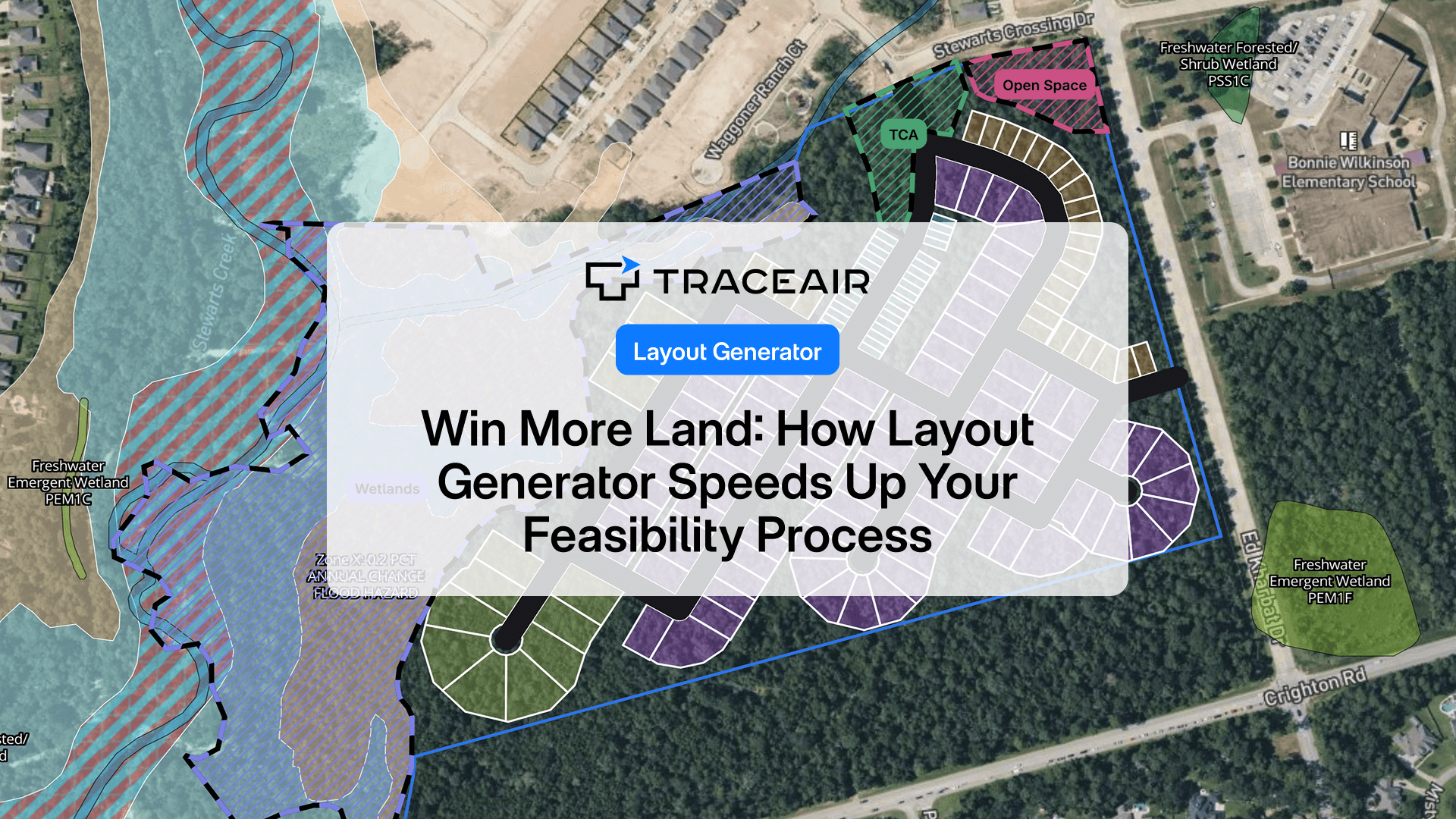
Read More