3 min read
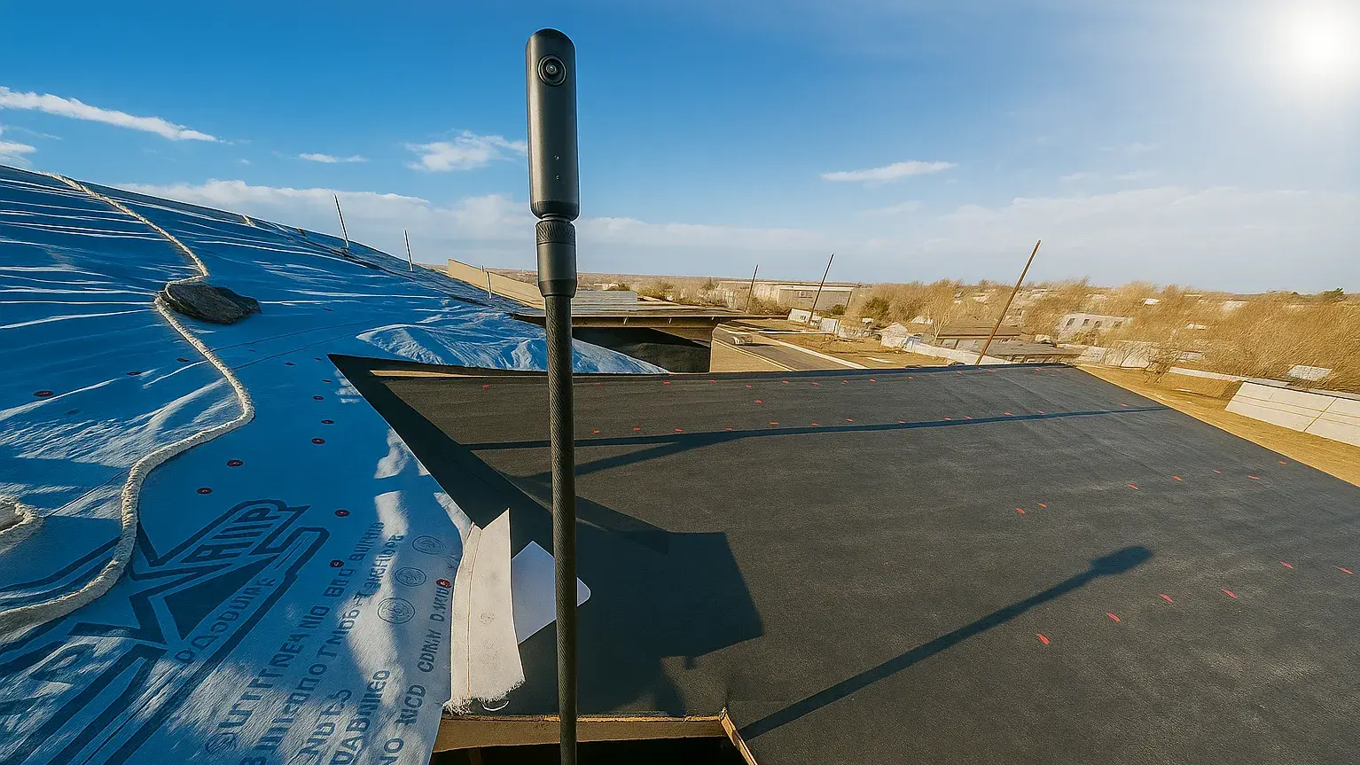
Vertical Construction Without Blind Spots: Protecting Every Build with 360° Documentation
An electrical line pinched against ductwork. Missed flashing at a roof penetration. The wrong truss installed in a critical location. Every VP of...

1 min read
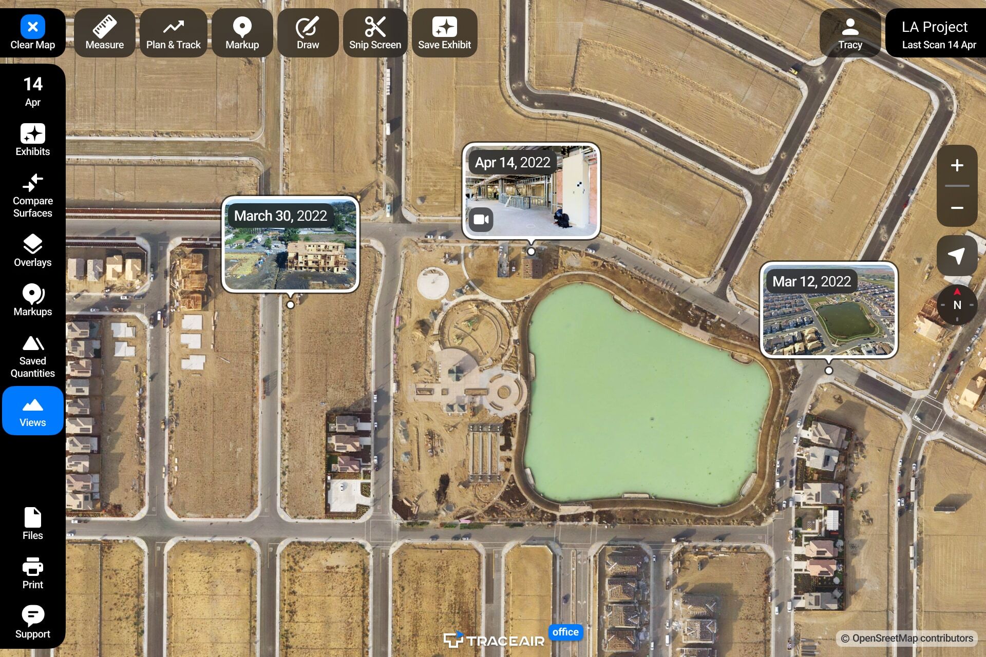
We’re excited to announce the launch of map rotation and upgrades to our 360° panorama feature within TraceAir. These major upgrades are available now within the platform and offer several new ways to gain more context, add clarity, and help you make even smarter decisions.

Map rotation allows you to rotate your project 360°. Simply select the compass and rotate. Align the map for printing, snipping, or simply a more comfortable on-screen viewing. While in the field, use My Location to find your position on a scan, and then reposition the map to align with your viewpoint.
For ease of navigation, we have added mini-previews on the map. With the new half-screen view, you can now view 360° panoramas alongside your scans and use all the tools and features of TraceAir without interrupting your workflow. 360° panoramas can be added to Exhibits for easy collaboration, and also shared outside of TraceAir via a link.

These updates will help you save time and increase productivity, allowing you to focus on important aspects of your projects. If you have any questions or feedback, please contact our team.
3 min read
An electrical line pinched against ductwork. Missed flashing at a roof penetration. The wrong truss installed in a critical location. Every VP of...
1 min read
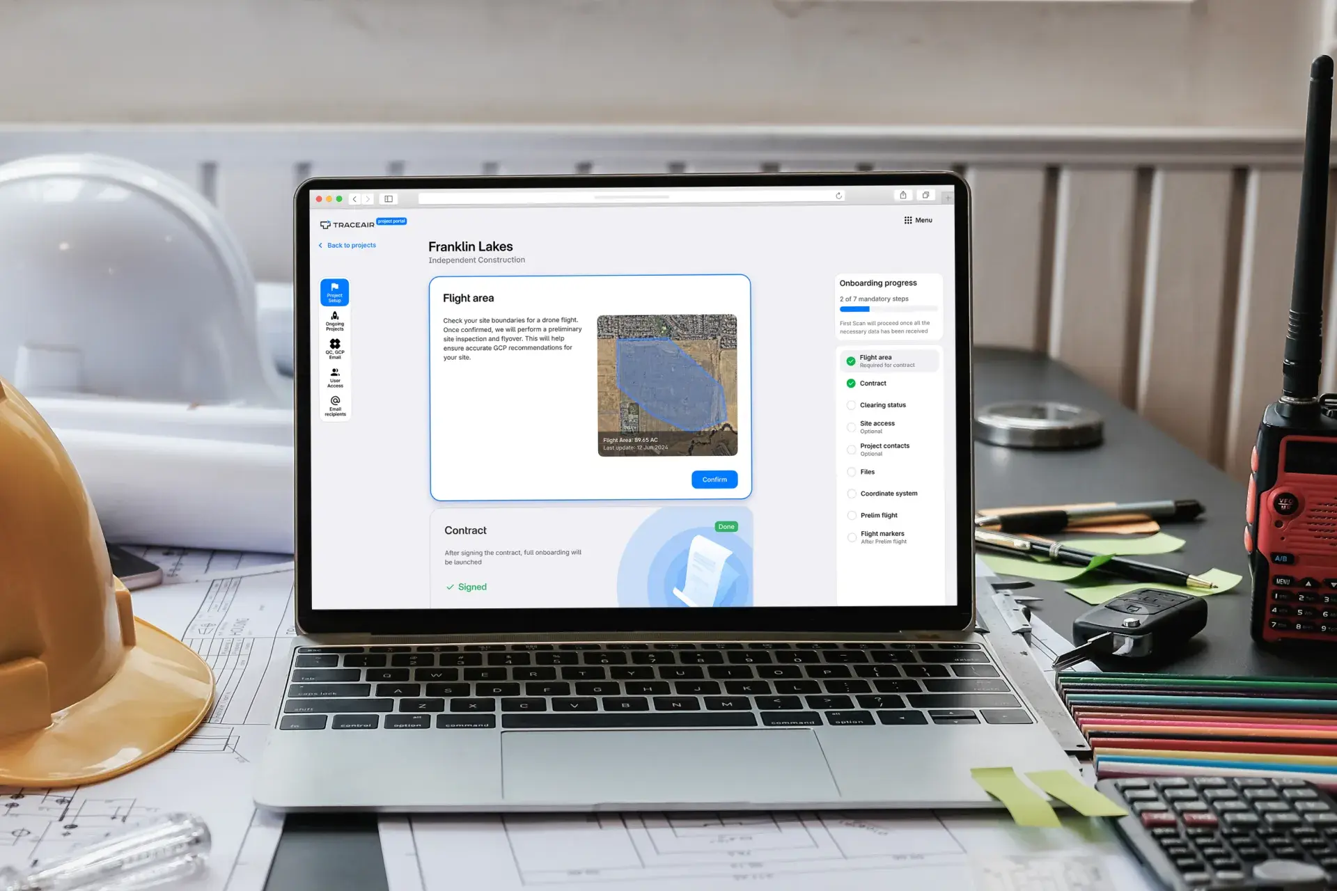
We’re excited to unveil the redesigned Projects Portal, featuring a sleek vertical sidebar navigation and an all-new progress bar that enhances...
1 min read
A New Look Thanks to your valuable feedback, we've created a refreshed and improved user experience that ensures efficiency and simplicity with...