1 min read
Customer Story: Tracking Contaminated Soil Quantities
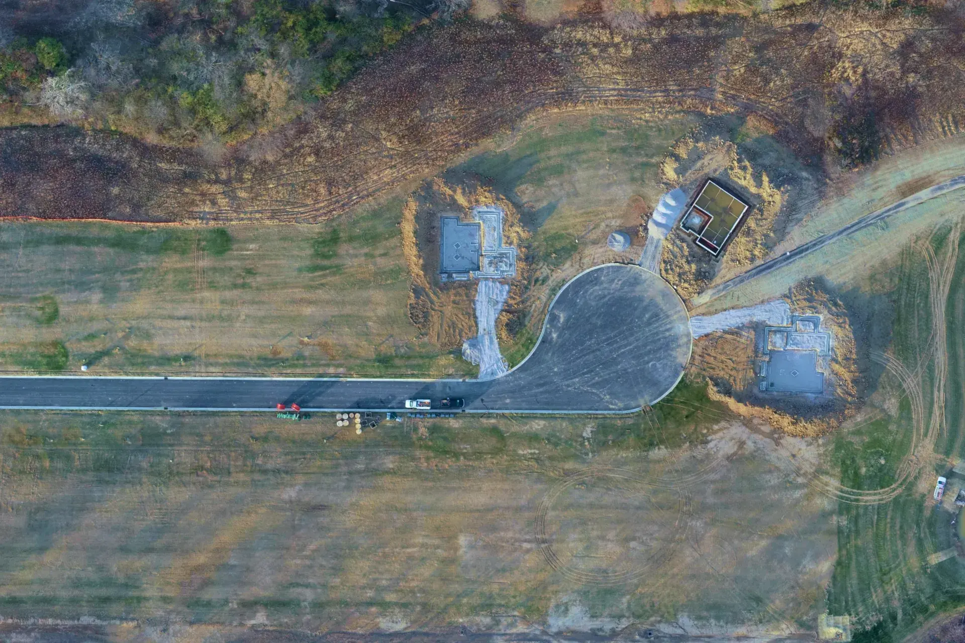
Accurate Material Tracking and Billing Quantities on a Contaminated Site Challenge Tracking movement and quantities of contaminated soil is...

1 min read

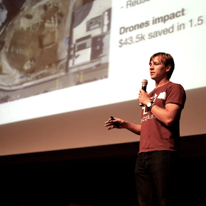
Stockpiles of crushed materials are difficult to track and can result in billing errors. Project drawings and documents aren't always aligned, and human errors can result in expensive rework and delays. TraceAir and Balfour Beatty presented the solutions to these challenges at a CMAA Tech Talk event.
On a 2.8 acre, design-build community college project, Balfour Beatty served as the General Contractor. The Project Manager used TraceAir to accurately track crushed materials generated on site and prevent errors in the field using overlays.
On this project, the grading contractor planned to use crushed materials generated on site during demolition, however tracking accurate quantities would have been difficult without regular surveying. This could have resulted in inaccurate billing and underpayment by the grading contractor.
Using TraceAir's high-resolution aerial images coupled with accurate material tracking tools, the Project Manager was able to accurately calculate stockpiles of crushed materials on site and quantify the amount used by week. Compared to typical surveying methods for measuring materials, using TraceAir's user-friendly tools was more efficient and less costly. The project manager estimated that TraceAir helped Balfour Beatty recuperate approximately $13,500 in materials sold to the grading contractor.
Additionally, this project had some discrepancies in the project documents, specifically the location of a manhole that was designed in the over excavation area. Using overlays, the project manager quickly identified this issue and developed a solution with his team before it became an expensive problem. He estimates that identifying this issue early saved the project $20,000.
TraceAir is also an essential tool for tracking project progress. Weekly aerial images are accurate within 1/10th of a foot, identifying and preventing errors in the field before they become costly. On this project, the project manager was quickly able to see when the grading contractor erroneously excavated beyond the limit. By catching this error early, he estimated he was able to save the project $10,000 in rework costs.
1 min read
Accurate Material Tracking and Billing Quantities on a Contaminated Site Challenge Tracking movement and quantities of contaminated soil is...
1 min read
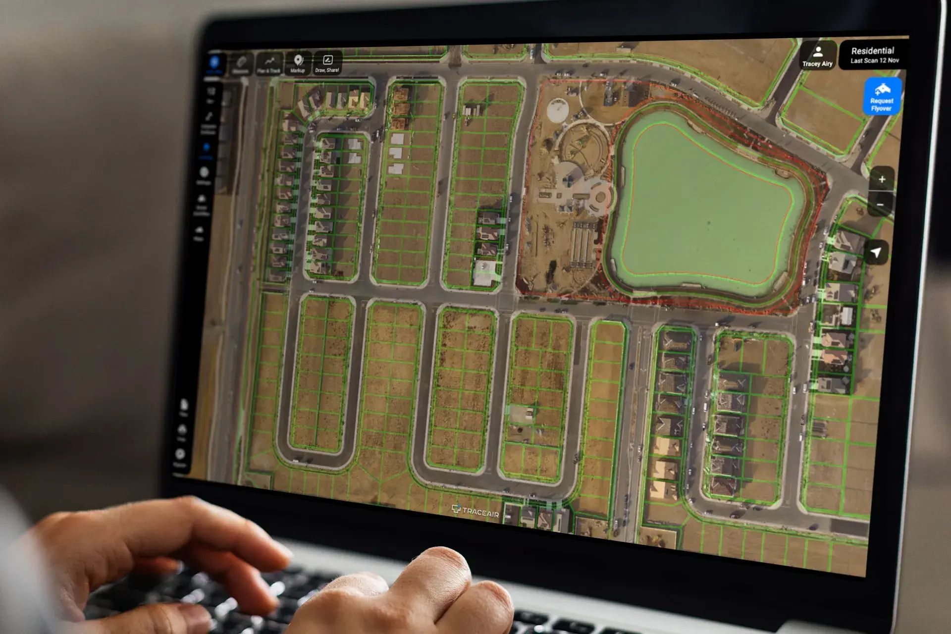
Remote Site Management at Brookfield Residential Challenge Land development professionals are responsible for multiple project sites across large...
5 min read
M/I Homes is a homebuilding company that has been building new home developments for over 40 years. Over that period, they’ve built more than...