Work Smarter

Empowering Texas MUDs Developers: The TraceAir Advantage

Explore how Municipal Utility Districts (MUDs) developers in Texas use TraceAir to streamline MUD formation, expedite development, and effectively manage MUD-related tasks.
December 4, 2023

According to the U.S. Census, Texas was the fastest growing state in 2023, welcoming 473,453 new residents. This population surge reflects the state’s allure, offering economic opportunities, diverse communities, and a high quality of life. However, keeping up with this rapid growth requires strategic planning and innovative solutions, especially for homebuilders and land developers.

To meet the demand, many Texas developers utilize Municipal Utility Districts (MUDs) to help fund utility projects and develop residential areas. These districts play a crucial role in developing communities and affordable housing, especially in areas outside city limits lacking municipal services. More than 1 million Texans live in a special district like MUDs.

How does a MUD work?

A MUD can be created by either the adoption of a district creation bill by the Texas Legislature or by the Texas Commission on Environmental Quality (TCEQ) following a petition and consent process described in the Texas Water Code. A publicly elected Board of Directors manages and controls all affairs of the MUD, subject to the continuing supervision of the TCEQ, whom ensures compliance with regulations. Projects within MUDs are financed through bonds, which are then paid off by homeowners through a MUD tax.

The Advantages of TraceAir for MUD Developers

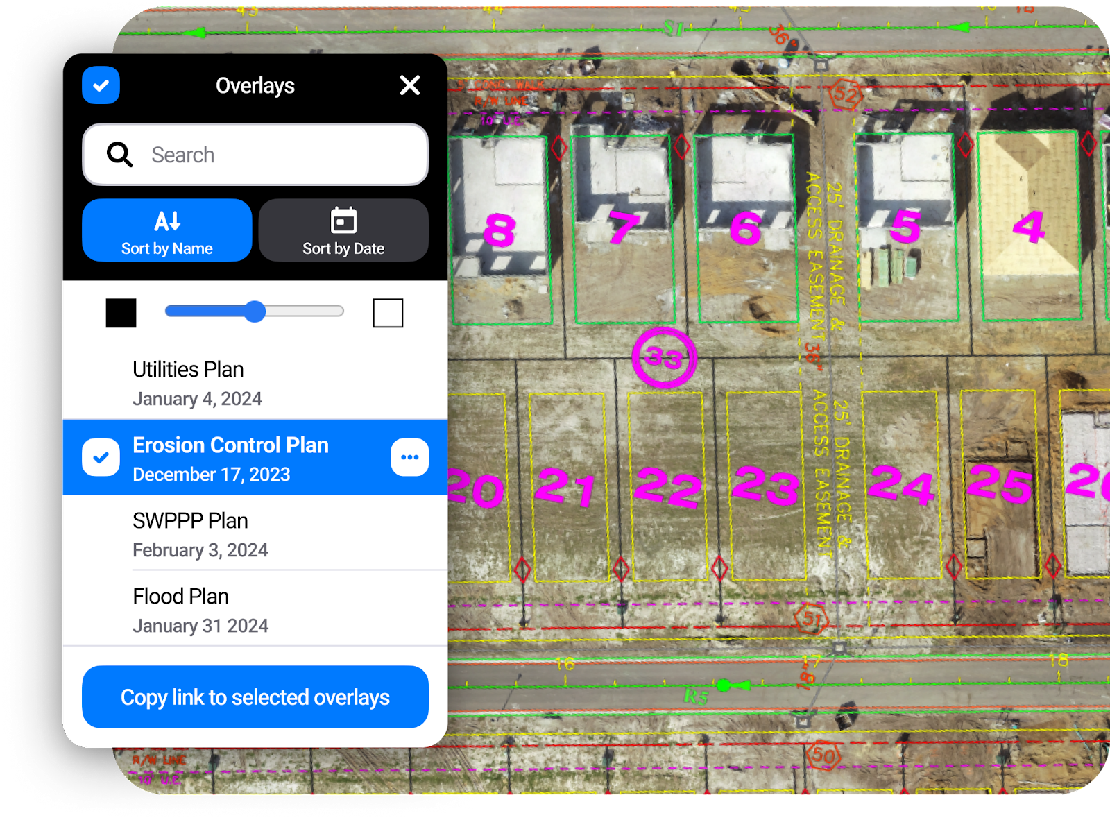
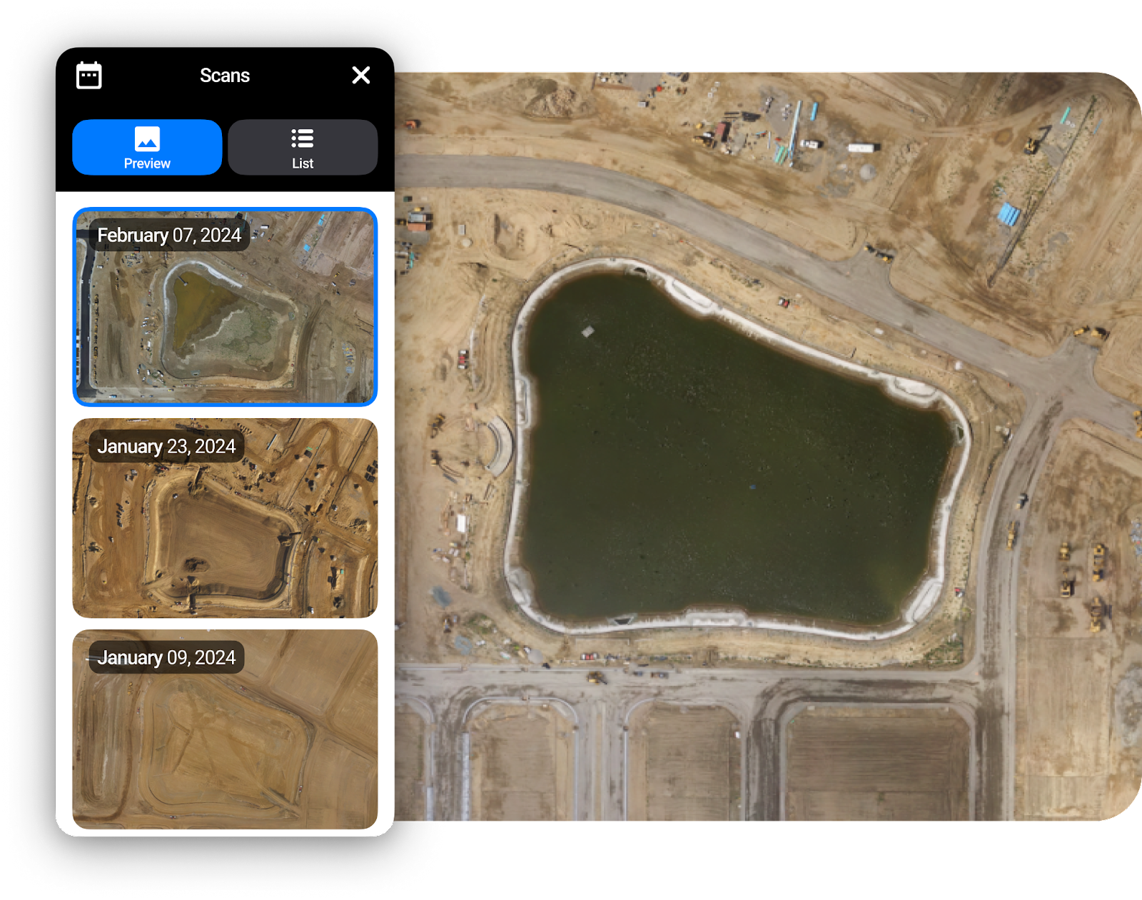
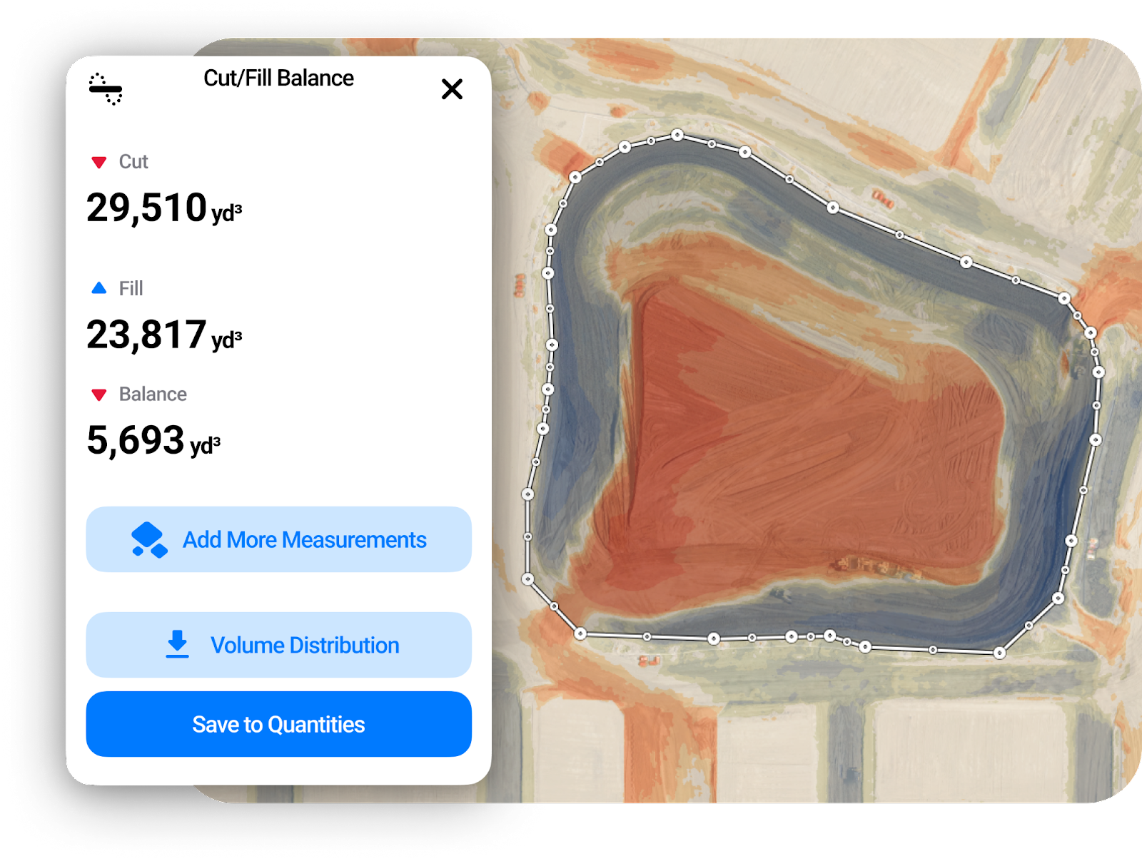
‍‍Built specifically for homebuilders and land developers, TraceAir is a cutting-edge software that empowers developers to streamline project management, track dirt quantities, and avoid setbacks. Over the last few years, TraceAir has gained rapid adoption by MUDs developers for its ability to accelerate development and maximize efficiency.

Leading the way, some of the state's standout master-planned communities, such as Bridgeland, The Woodlands, and Harvest Green, have seamlessly integrated TraceAir into their operations, setting a high standard for efficiency and precision. Benefits to MUD developers include:

  • Streamlining MUD Formation: Forming a MUD is a big endeavor, requiring meticulous planning and petitioning. TraceAir facilitates precise planning, allowing developers to make the most of the land. TraceAir is also a valuable tool to present these plans with clarity and impact.

    Using high-resolution aerial photos and heat maps of volumetrics, developers can provide a comprehensive understanding of the current property and topography. Leveraging TraceAir's overlay tools, they can effectively showcase future housing plans, amenities, Stormwater Pollution Prevention Plans (SWPPP), flood plans, and other crucial elements.
Upload project plans and drawings into TraceAir to compare current site conditions and ensure alignment.
  • Regulatory Compliance: With the help of TraceAir, developers can navigate the regulations and reporting requirements set by the Texas Commission on Environmental Quality (TCEQ) and other governing bodies with greater ease. In addition to the ability to overlay plans, TraceAir provides visual documentation at every stage of the project, providing project members and regulatory agencies with a clear understanding of alterations and developments over time. TraceAir maintains a historical archive that can be referred back to at any time.
  • Enhanced Collaboration and Communication: With so many parties involved, collaboration is key to successful MUD developments. TraceAir promotes transparency and collaboration by providing users with unlimited users at no additional costs. Top developers embrace this by sharing TraceAir with MUD board members, regulatory authorities, contractors, and stakeholders. Using TraceAir as the single source of truth minimizes misunderstandings, and ensures everyone involved is aligned with the project's vision.
Effortlessly monitor progress throughout your project within TraceAir. Utilize aerial photos, overlays, and markup tools to foster clear communication and collaboration among your team, stakeholders, and MUDs board members, ensuring alignment and efficiency.
  • Accelerated Projects: Time is a critical factor for MUDs developers. The faster a project is completed, the sooner the developer can begin to be reimbursed. With remote accessibility and user-friendly tools, TraceAir facilitates smart-decision making and collaboration from anywhere. Additionally, the data within TraceAir empowers contractors and developers to make decisions without relying on third-party consultants, significantly reducing delays. 

Potential for Reimbursement of TraceAir Through MUDs

‍Because TraceAir is directly tied to and beneficial to the construction phase of development, costs associated with TraceAir may be eligible for reimbursement through MUDS. To get TraceAir reimbursed through MUDs, developers must navigate the intricacies of MUD financing and reimbursement processes. Here are key steps to consider:

  • Incorporate TraceAir in Project Proposals: When presenting project proposals to TCEQ and MUDs boards, developers should include TraceAir in their plans and highlight the benefits of using TraceAir to streamline processes, reduce costs, accelerate schedules, and enhance overall project efficiency.
Accurate to 3 centimeters, TraceAir provides an easy and comprehensive solution for progress tracking. TraceAir maintains a historical archive of scans, facilitating effortless comparison of progress over time.
  • Understand MUD Financing & Reimbursements: As the governing board of MUDs, the TCEQ oversees financing and reimbursements. Developers should work closely with TCEQ to understand what documentation and reporting are needed to be eligible for reimbursement.
  • Showcase Benefits of TraceAir: Clearly demonstrate how TraceAir benefits the MUD aspects of your projects, such as tracking cut/fill on detention ponds, overlaying stormwater plans to ensure accuracy, maintaining documentation, and utilizing TraceAir’s planning tools to optimize space for amenities. 
Select any area to view the cut and fill quantities of your project. Use this information to balance your site, track remaining quantities, and plan your operations.
  • Compliance with MUD Regulations: Show how TraceAir promotes compliance with MUD regulations and environmental initiatives. This may involve working closely with the TCEQ and other regulatory bodies to address any concerns. Utilize tools within TraceAir, such as aerial photos and overlays, to showcase compliance.
  • Engage with MUD Board and Stakeholders: Utilize TraceAir’s unlimited licenses to engage in transparent communication with stakeholders, emphasizing alignment of goals and working together to ensure long-term community success.

Learn More

As Texas continues to experience unprecedented growth, the importance of innovative solutions like TraceAir becomes increasingly evident. More than a software, TraceAir is your partner in success. Our mission is to empower land developers with tools and data to accelerate their projects and set new industry standards for innovation and efficiency.

To learn how your projects could benefit, schedule a demo today.

Get the latest news from TraceAir

Let’s work together

Reimagine your experience

Want to learn more? Let us show you how TraceAir can help you achieve site balance, accelerate your schedule, and save money.

Book a demo